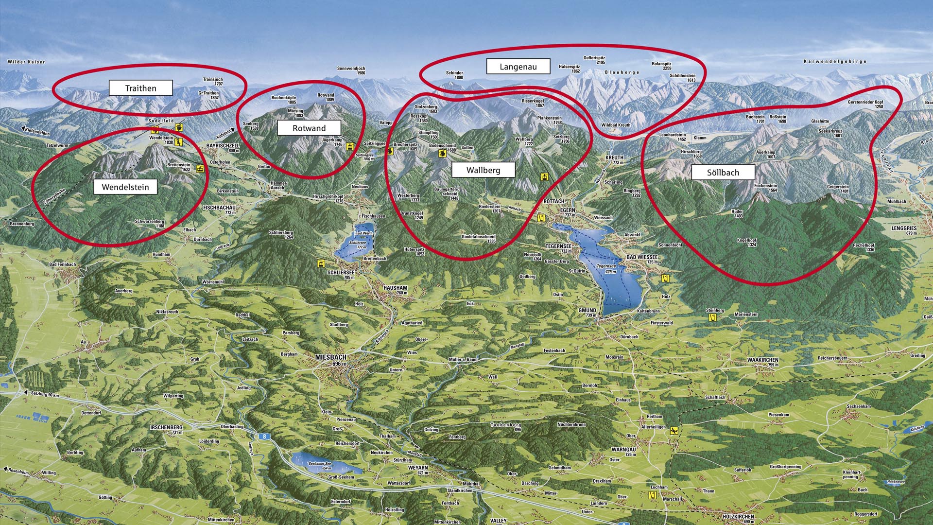
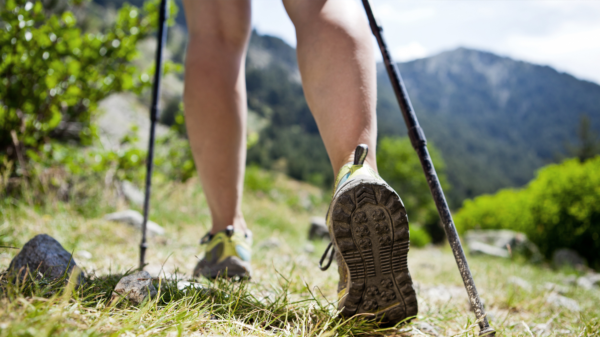
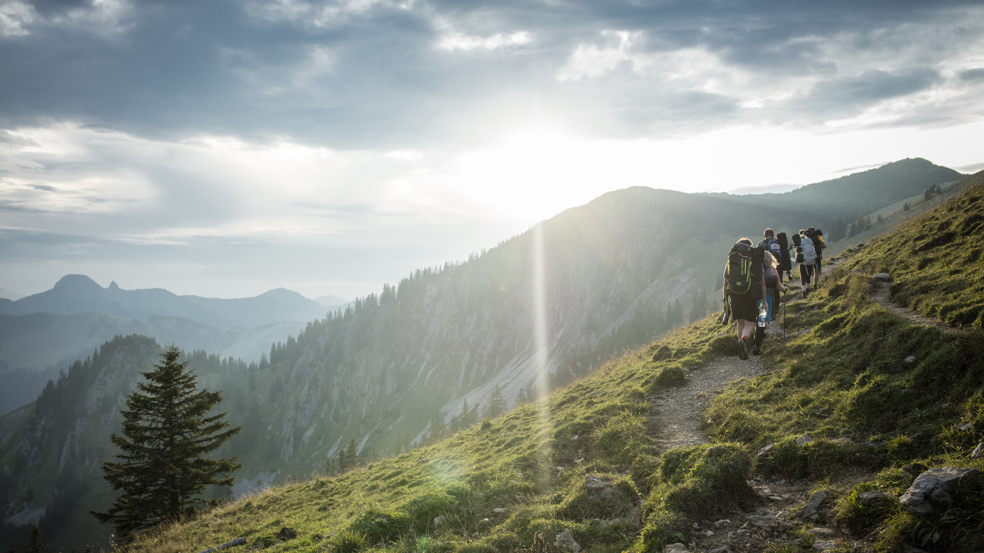
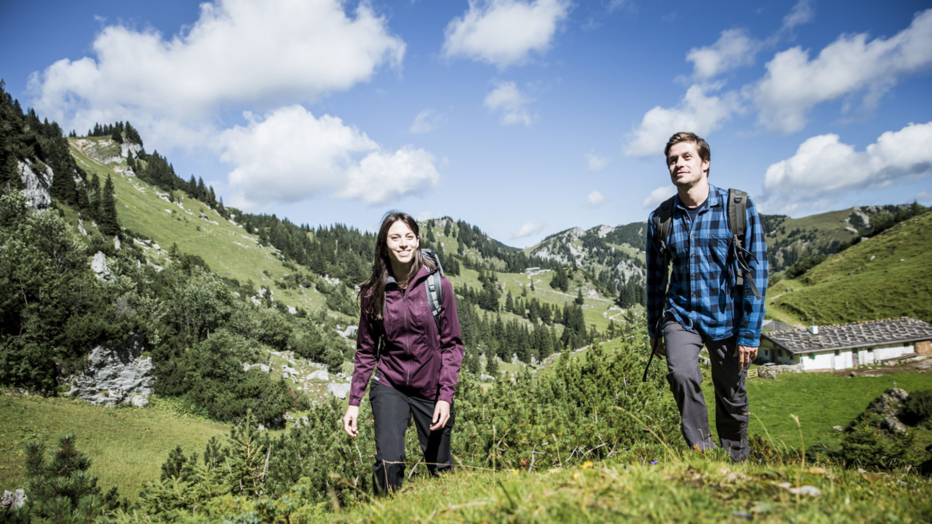
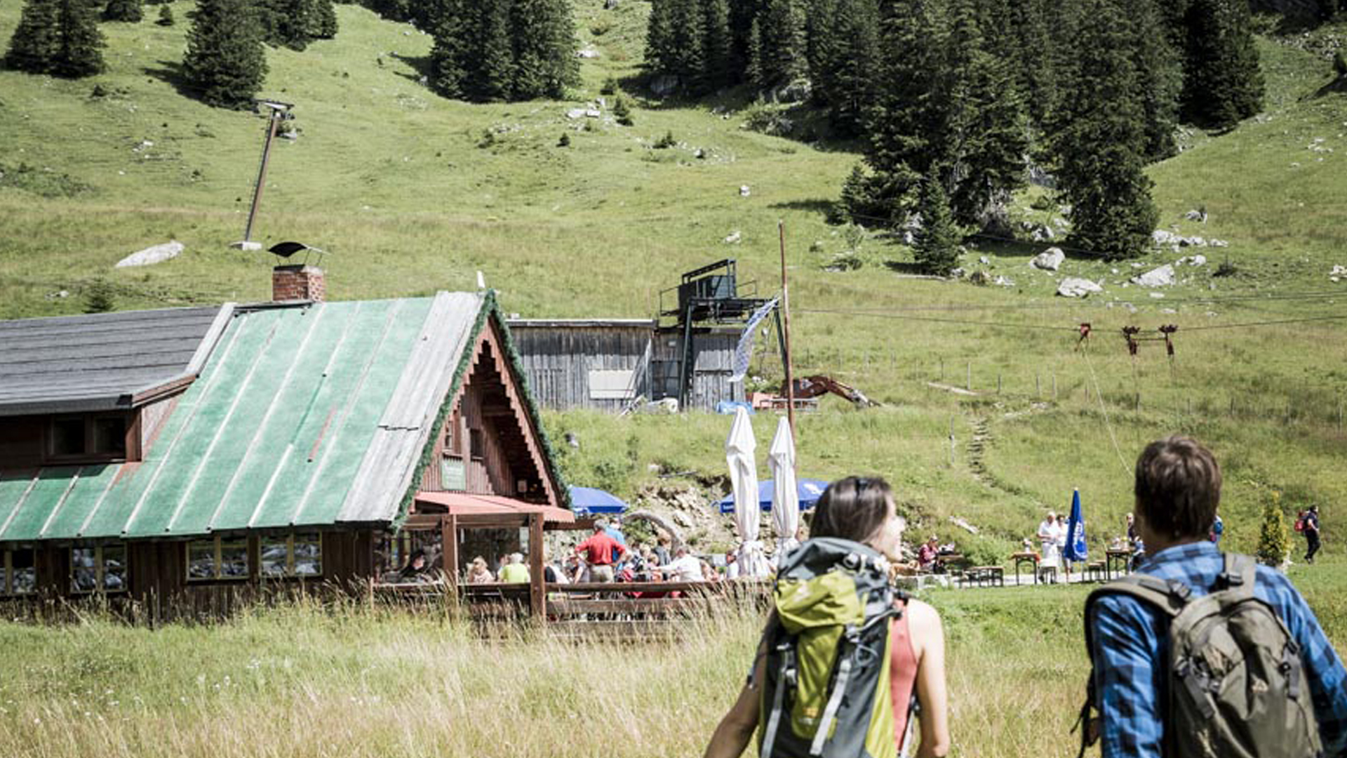
Hiking and Mountains
 |
 |
 |
 |
 |
 |
|
|
|
|
|
|
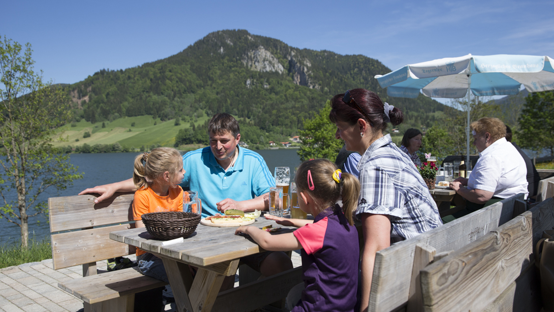
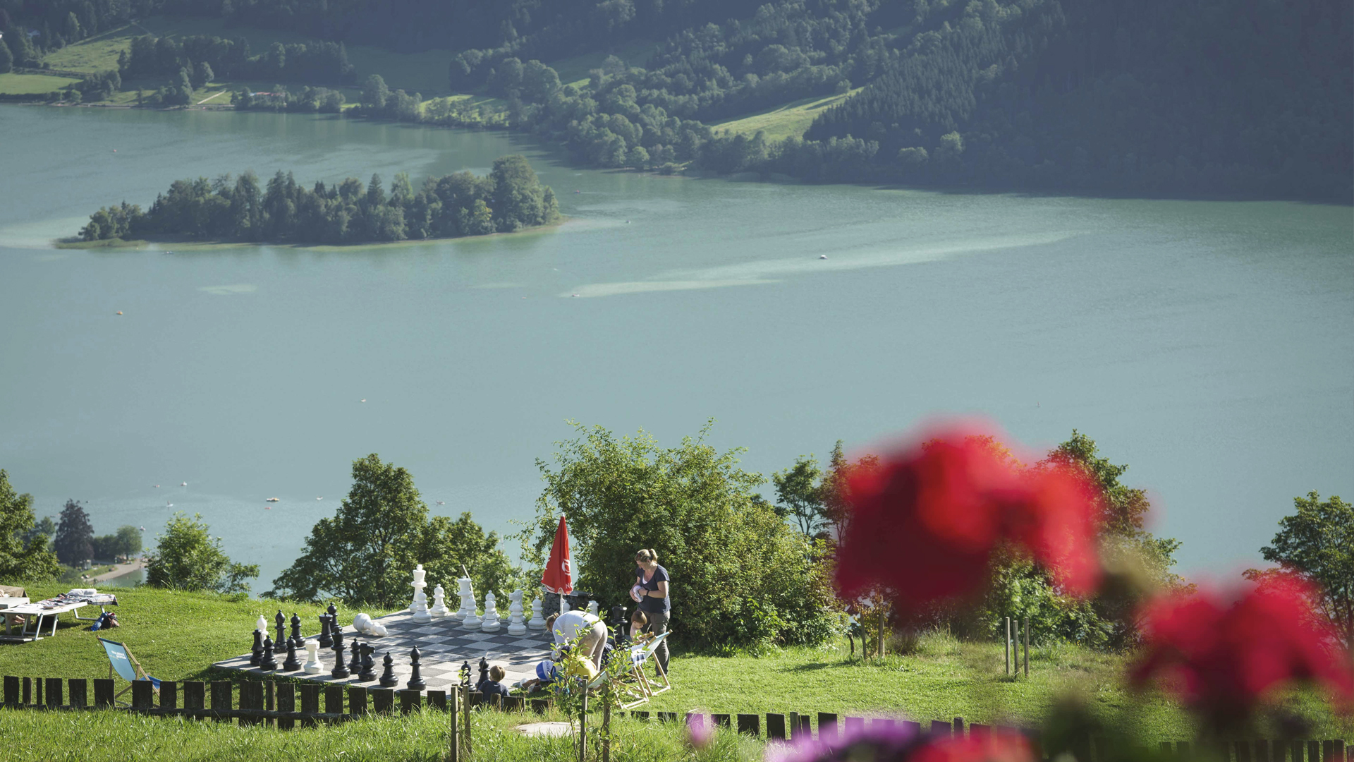
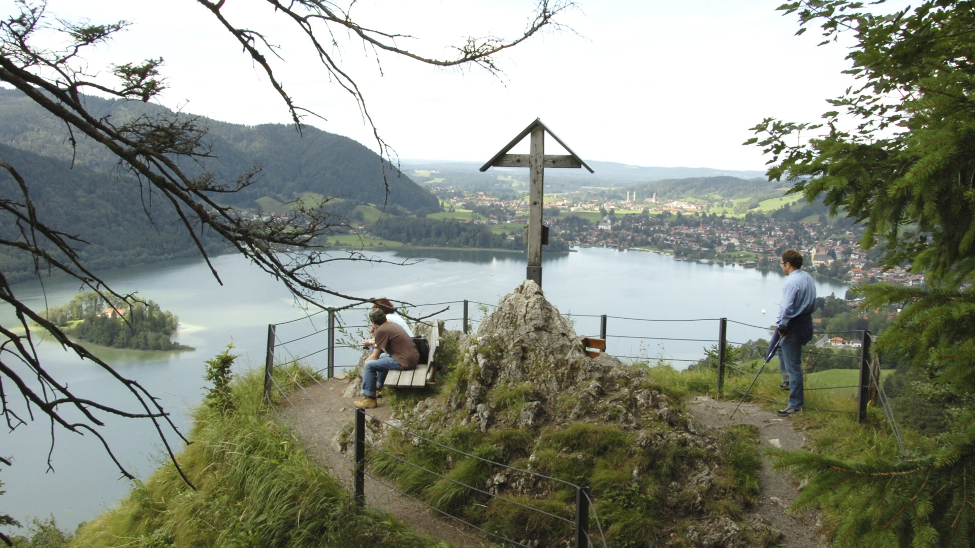
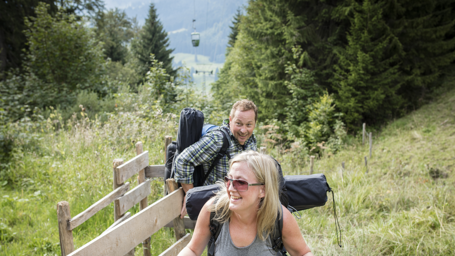
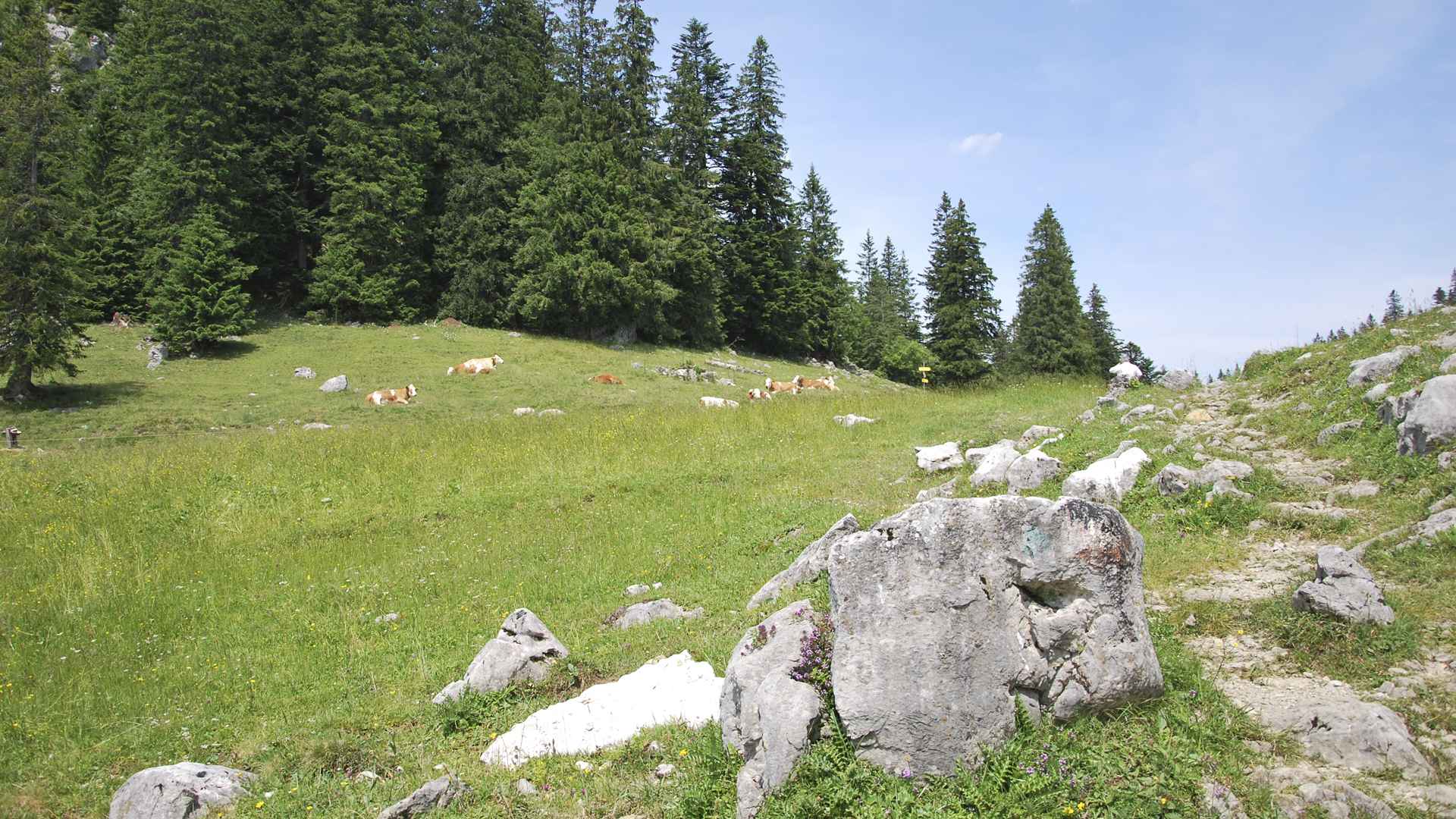
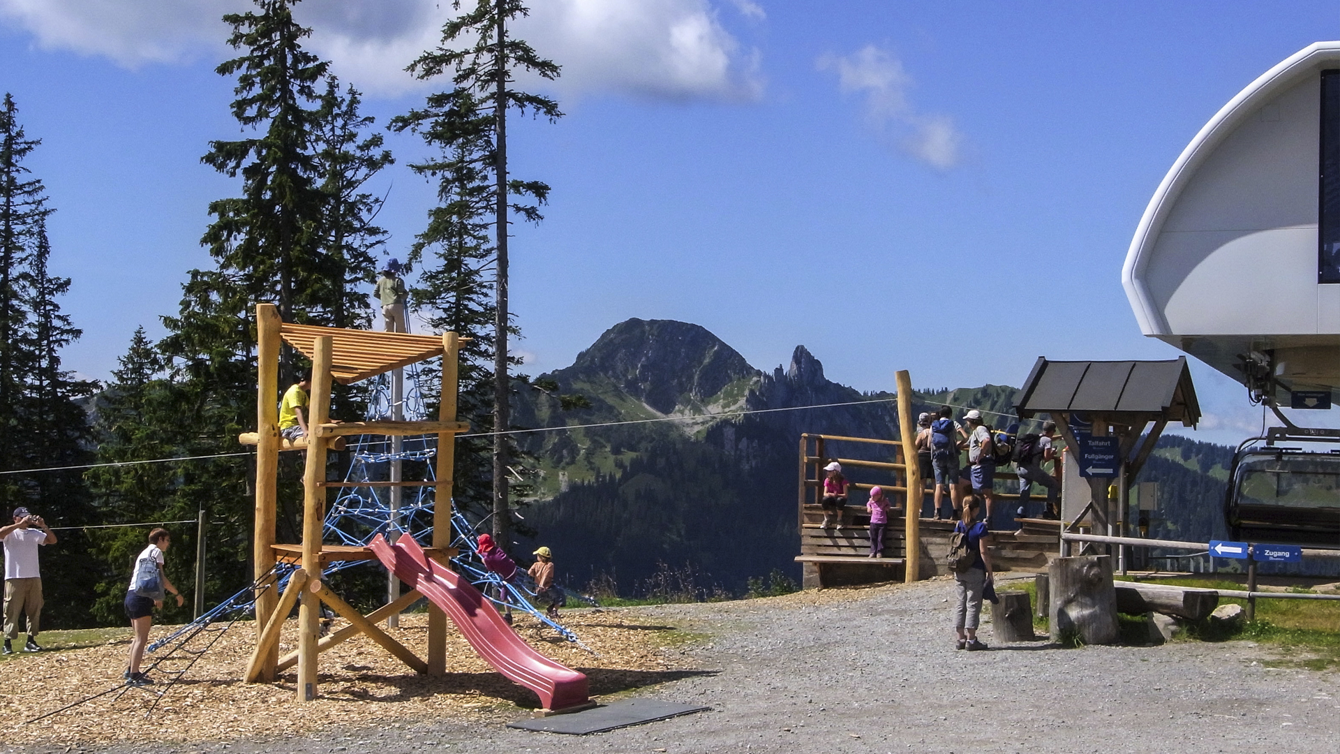
The Tree Adventure Trail is one of the most popular mixed-use paths and also a Circular Walk around the Schliersee. Even children enjoy this tour very much. The complete route is about 7.3 kilometres long and without having a break, it takes you approximately two hours to walk around the whole lake. As the path is bituminised, it is also possible to walk around the Schliersee in wintertime. The lowest point is 776 metres and the highest point is 792 metres. Ascent and descent amount to 33 metres. Also people with low condition (two stars) can master the distance easily. In Cycle Route Maps and Hiking Maps the category “adventure” is tagged with three stars, the category “landscape” is tagged with four stars. All information about the Circular Walk around the lake and Tree Adventure Trail Schliersee occur without guarantee. Walking around the Schliersee is at your own risk.
You can travel to Schliersee by car or by train. If you choose to arrive by car, the best way to get to Schliersee is to drive on the A 8 and then take the exit to Weyarn. Now you should take the state road ST 2072 and the national road B 307 heading to Schliersee. You can park your car near the camp-site or at the “Vitalwelt Schliersee”. Hourly, during rush time even every half an hour, you can hop onto a train of the Bayerische Oberlandbahn (BOB) at the central train station in Munich and get off at the main station in Schliersee.
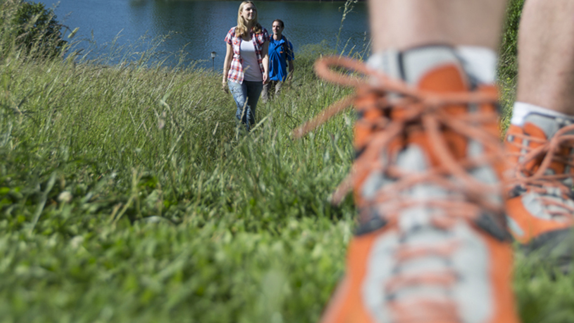
Before going for a walk, please make sure to wear sturdy shoes. Also do not forget to wear proper clothing. A rain jacket or an umbrella is also important - otherwise you could turn out being soaking wet after a sudden heavy shower.
Alongside the Tree Adventure Trail you will find 19 boards with information about the trees and bushes nearby the riverside. One story is about the 100 year old copper beech. During the times without weather forecasts, the locals hit a notch in the stem of this tree at the beginning of November. If the stem remained dry, it meant that a hard and strict winter would follow. Another story along the way is the story of the engagement fir. In fact it is not really a fir, but a spruce. According to the legend many lovers celebrated their engagement under this tree. You also find a few Siberian trees on the way.
The Circular Walk around the lake and Tree Adventure Trail Schliersee start at the camp-site Lido. Walk to the “Rixner-Alm”, an alpine hut near the western banks of the Schliersee. Here you can have a snack and stay for a little while. Afterwards the path directs you to the boathouses of Fischhausen - a lovely setting for a souvenir photo. The next stop on the way is at the “Vitalwelt Schliersee”. Here you can have a swim, visit the thermal springs or sauna of the monte mare Schliersee.
Difficulty easy
Track length in metres 7,3 km
Ascent in metres 33 m
Descent in metres 33 m
Duration 1:51 h
Lowest point in metres 776 m
Highest point in metres 792 m
Condition **||||
Adventure ***|||
Landscape ****||
The Circular Walk Schliersberg and Schliersbergalm offers not only action (Adventure: five stars), but also untouched trails with an unique view (Landscape: five stars). This is a moderate tour of the so called “Natural Family”-fascination area. This three hours and thirty minutes walk is a combination of an untouched trail and a prepared theme walk. Adults and children can have lots of fun by visiting the sledge run, playing with the interactive gaming devices or just swimming in the water or playing on the playgrounds. Hearty food and drinks you will also find on your way.
The whole path has a length of 9.1 kilometres. The lowest point is 500 metres and the highest point is 498 metres. Ascent lies at 1.263 metres and descent at 791 metres. If you do not want to walk the whole tour, you can take the aerial passenger line in order to reach the Schliersbergalm and take the toboggan run down into the valley. The sledge run is only accessible during nice weather.
The tour starts and end in Schliersee. You can arrive by car or by train. Every hour the Bayerische Oberlandbahn (BOB) leaves from the main station in Munich and you can get off in Schliersee. If you prefer travelling by car, you can take the Autobahn A 8 and take the exit to Wayarn. Afterwards stay on the state road ST 2072 and the national road B 307 to Schliersee. At the main train station in Schliersee you can park your vehicle (fee required).
For your safety, please wear alpine boots and adequate clothing. Also make sure carrying some food and beverages with you. In order to avoid sunburns and a sunstroke it is necessary to wear head covering and put on some suncream. All information about the Family tour - Schliersberg and Schliersbergalm occurs without guarantee. Walking this tour is at your own risk.
Location details:
There are to ways to walk to the hillsides of the Schliersberg. The easier way directs you to the “Schatzlweg”. Just sty left and follow the road up the hill. The right path is much more demanding and very steep. Both paths meet at the hillside if the Schliersberg. Now follow the way through the woods until you reach a sign showing you the way to Schliersberg / Rhonberg, Now turn left and follow the path until you reach the forested peak of the Schliersberg. Now you can stop and look at the wonderful landscape surrounding you.
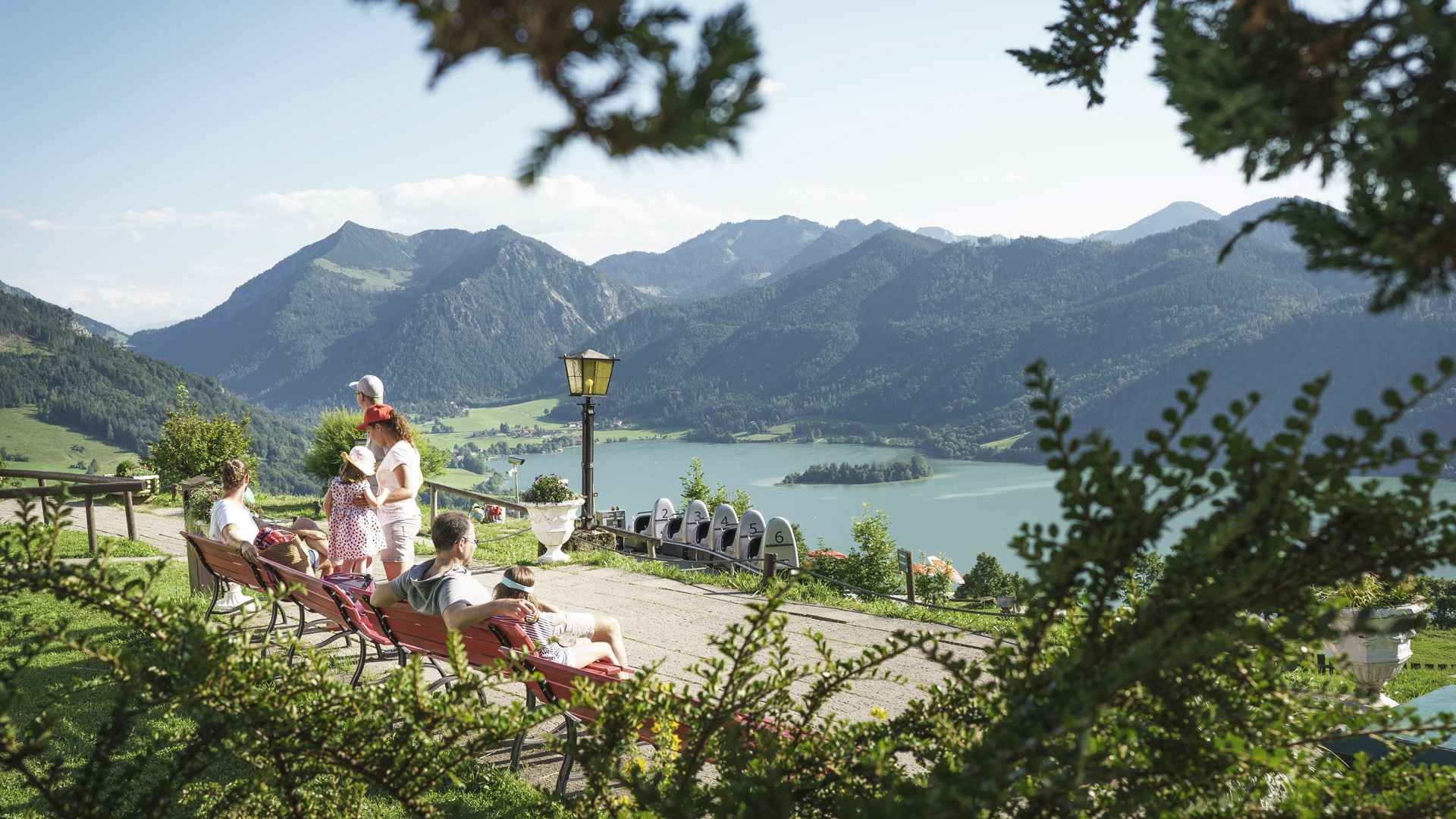
After enjoying the wonderful sight, walk up the hill and then turn left to the Schliersbergalm. The Schliersbergalm is an alpine hut where you can sit down and enjoy a meal and something to drink. Just look for a seat at the garden terrace. Your children can play on the playground, after you have had a regional speciality. Toddlers will also have lots of fun. They can play inside the big basin, filled with small balls. You also can play crazy golf near the edge of the forest. If you do not want to walk back, just take the toboggan run down into the valley. You and your family with love riding down the hill.
You rather would like to walk the switchback path - no problem! Just walk down the street back to the lake. This path leads you to the Leitnerstrasse and the main train station of Schliersee.
Difficulty moderate, Duration 3:30 h
Track length in metres 9,1 km
Ascent in metres 498 m
Descent in metres 500 m
Lowest point in metres 791 m
Highest point in metres 1263 m
Condition ***|||
Tekkers ***|||
Adventure ****||
Landscape ****||
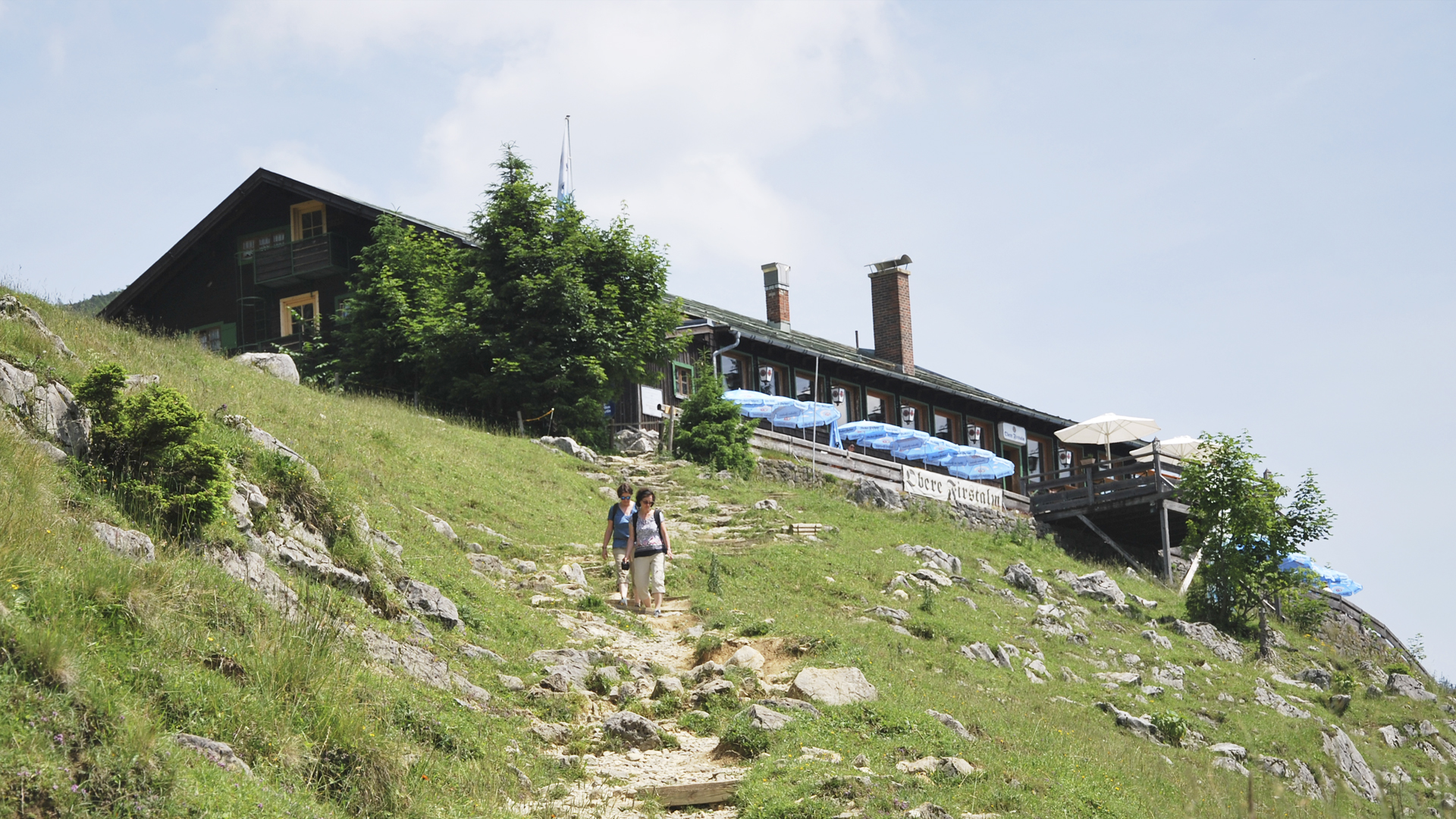
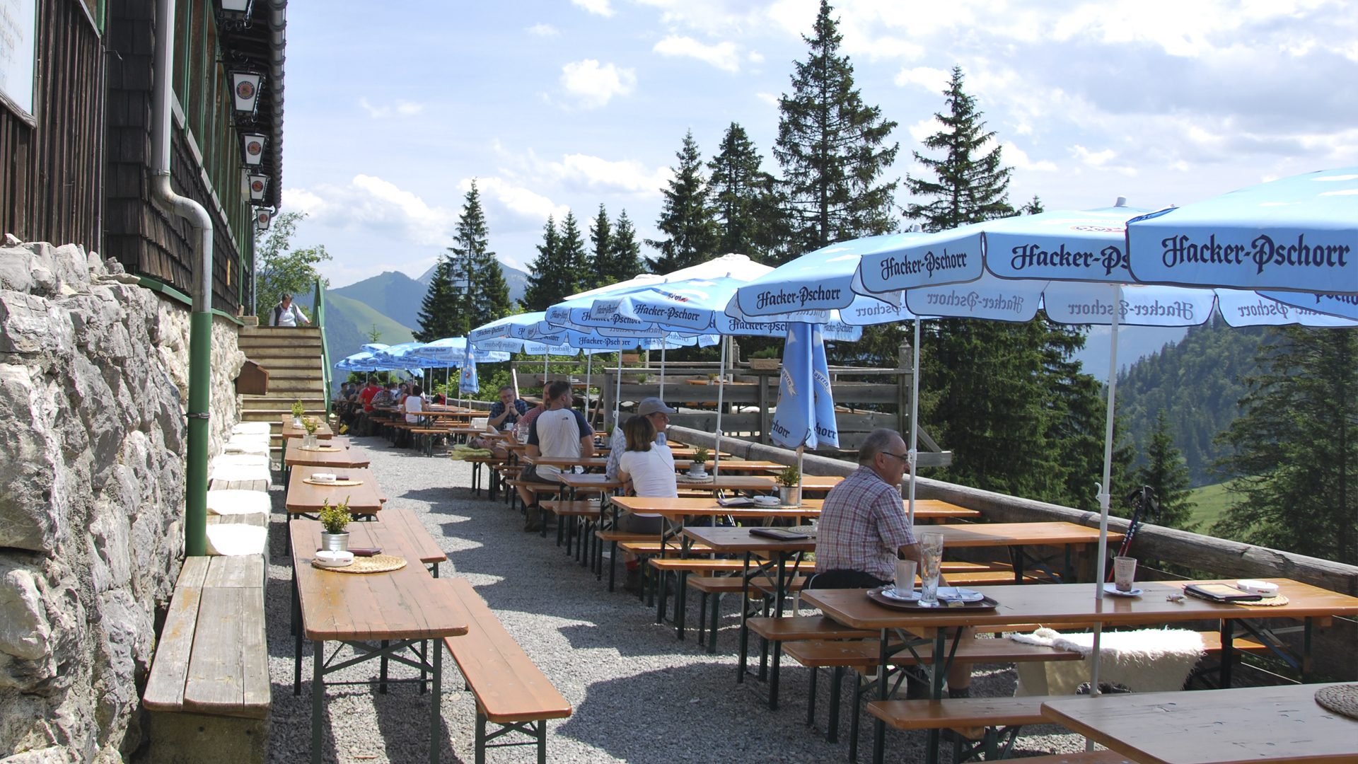
Walking to the “Obere Firstalm” is a very easy tour stated by Hiking Maps. It is part of the so called “Natural Family”-fascination area and is recommended as ideal tour for families with children. The route has a length of 2,5 kilometres. This two and a half hour walk is a combination of an untouched trail and a prepared theme walk. The path is built out very well and so you even can take a baby carriage with you. Don´t forget to visit a mountain inn, before going back home. There you can enjoy some regional dishes, e.g. a Bavarian “Brotzeit” or a dessert. The inn is opened every day from 10 a.m. to 5 p.m. During the winter season you can also stay until 10 p.m., if the snow conditions are good.
The lowest point is 1.127 metres above the sea and the highest point is 1.372 metres. The ascent lies at 259 metres. You can arrive by car or by train. Every hour the Bayerische Oberlandbahn (BOB) leaves from the main station in Munich and you can get off in Schliersee or Fischhausen-Neuhaus. From here you then can take the RVO-Bus to the so called “Spitzingsattel”.
If you prefer travelling by car, you can take the Autobahn A 8 and take the exit to Weyarn. Afterwards stay on the state road ST 2072 and the national road B 307 to Schliersee. Now follow the route to Spitzingsee and park your car at the parking site Spitzingsattel. The fee for a whole day only costs 4,- Euro.
Location details:
As soon as you have reached the Spitzingsattel, please do not forget to look at the wonderful landscape surrounding you. Then walk to the path along the toboggan run. The toboggan run is about 3 kilometres long and leads you through a forest. During the winter season you can bring your own sleigh with you and pull your children through the snow. You also can borrow a bob-sleigh at the “Obere Firstalm” and have fun in the snow all day long.
If you like to stay over night, you can rent a room at the Obere Firstalm. The mountain inn also provides rooms for festivities, e.g. weddings, anniversaries, company events.
Contact:
Obere Firstalm
83727 Spitzingsee
Tel.: +49 (0)8026 / 73 02
Fax: +49 (0)8026 / 71 731
E-Mail: info(at)firstalm.de
www.firstalm.de
Difficulty easy
Track length in metres 2,5 km
Ascent in metres 259 m
Descent in metres 15 m
Duration 2,5 h
Lowest point in metres 1127 m
Highest point in metres 1372 m
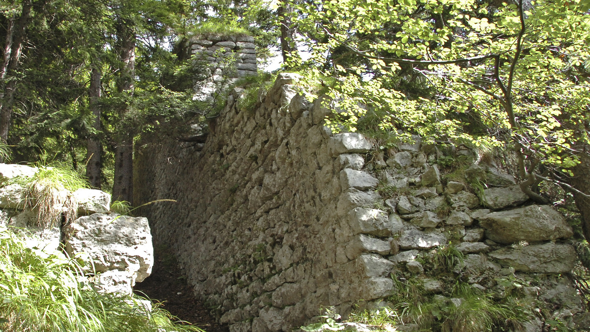
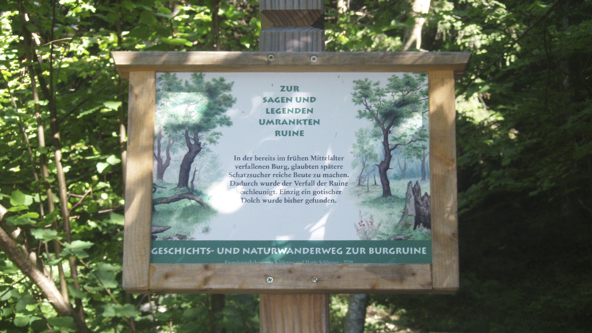
Please note that access to the Hohenwaldeck castle ruins and the viewpoint is currently closed! The circular route can be walked on.
Walking on the mountain trail between Schliersee and Neuhaus you will pass by the Castle ruin Hohenwaldeck - an ideal tour for you and your family. In order to manage this moderate tour you need a good condition (four stars). The whole area offers lots of adventures (five stars) and has a length of approximately 9.7 kilometres. The highest point of the circular walk is 1.051 metres and the lowest point is 776 metres. Ascent and descent are at 336 metres. The tour starts and ends at the parking site Unterleiten/ Schliersee.
You can arrive by car or by train. Every hour the Bayerische Oberlandbahn (BOB) leaves from the main station in Munich and you can get off in Schliersee. If you prefer travelling by car, you can take the Autobahn A 8 and take the exit to Weyarn. Afterwards stay on the state road ST 2072 and the national road B 307 to Schliersee. Now follow the signs leading you to the parking site Unterleiten. All information about the Family tour - Castle ruin Hohenwaldeck occurs without guarantee. Walking this tour is at your own risk.
Location details:
Walk from the parking site Unterleiten to trial number 674. Now walk along the path and turn left as soon as you have reached the last house on the street. Directly at the rear vault please go further in until you have reached a tarred street. This street will lead you to the farm called Oberleiten. Nearby you will have a wonderful view of the mountains and the lake. Below the farm you will find a turning. Please take the path leading you to the right. Walk through the fences until you reach a huge field. On the other side there is a forest. Follow the way through the forest and walk along the switchback until you reach the junction to the Castle ruin Hohenwaldeck.
Only a few steps further and you will find the remains of the castle ruin. The former castle lies on a rock shelter. You can sit on one of the two benches near the ruin and take a look around you. A sign next to the castle ruin, you can read the story of the Castle Hohenwaldeck.
Now it is time to go back. The path will lead you to the junction. On the right side you will see the forest. Just walk down the road to the national road B 307 in Fischhausen. Here you can take a break and enjoy a typical Bavarian meal at a restaurant. If you like to walk a few more steps, just follow the path around the lake. If the weather is nice and warm - how about having a swim? You will find lots of bathing places which are free of charge. On the eastern bank you can take a shortcut in order to reach the point of departure much faster. Another fast way to get back to the parking site Unterleiten is to book a trip with a motorboat. In Fischhausen you can catch the motorboat and drive to the Seehotel Schliersee Hof. From here you only need a few minutes to arrive at the parking site in Unterleiten.
Difficulty moderate
Track length in metres 9,7 km
Ascent in metres 366 m
Descent in metres 366 m
Duration 3:0 h
Lowest point in metres 776 m
Highest point 1051 m
Condition ****||
Adventure *****|
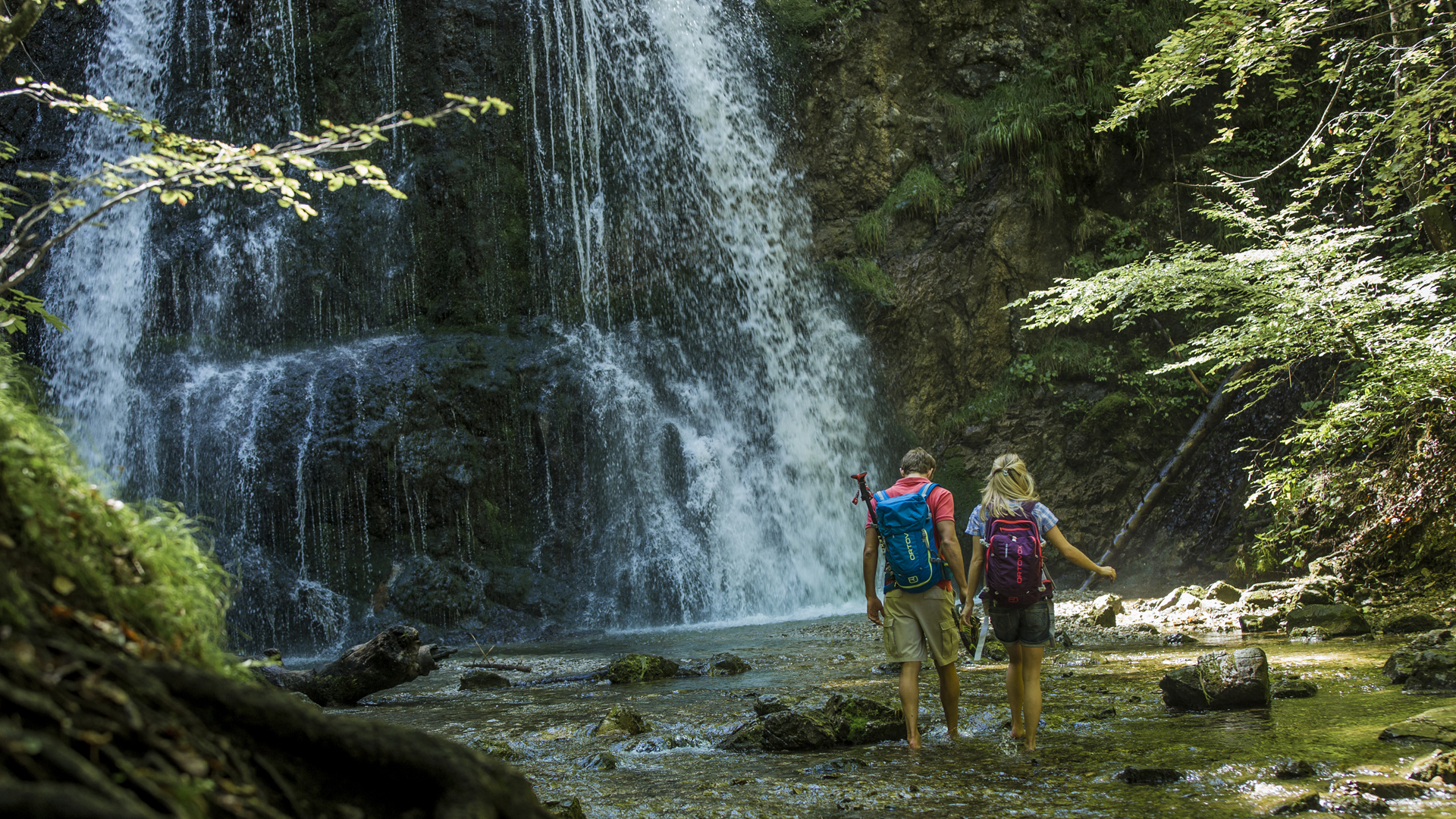
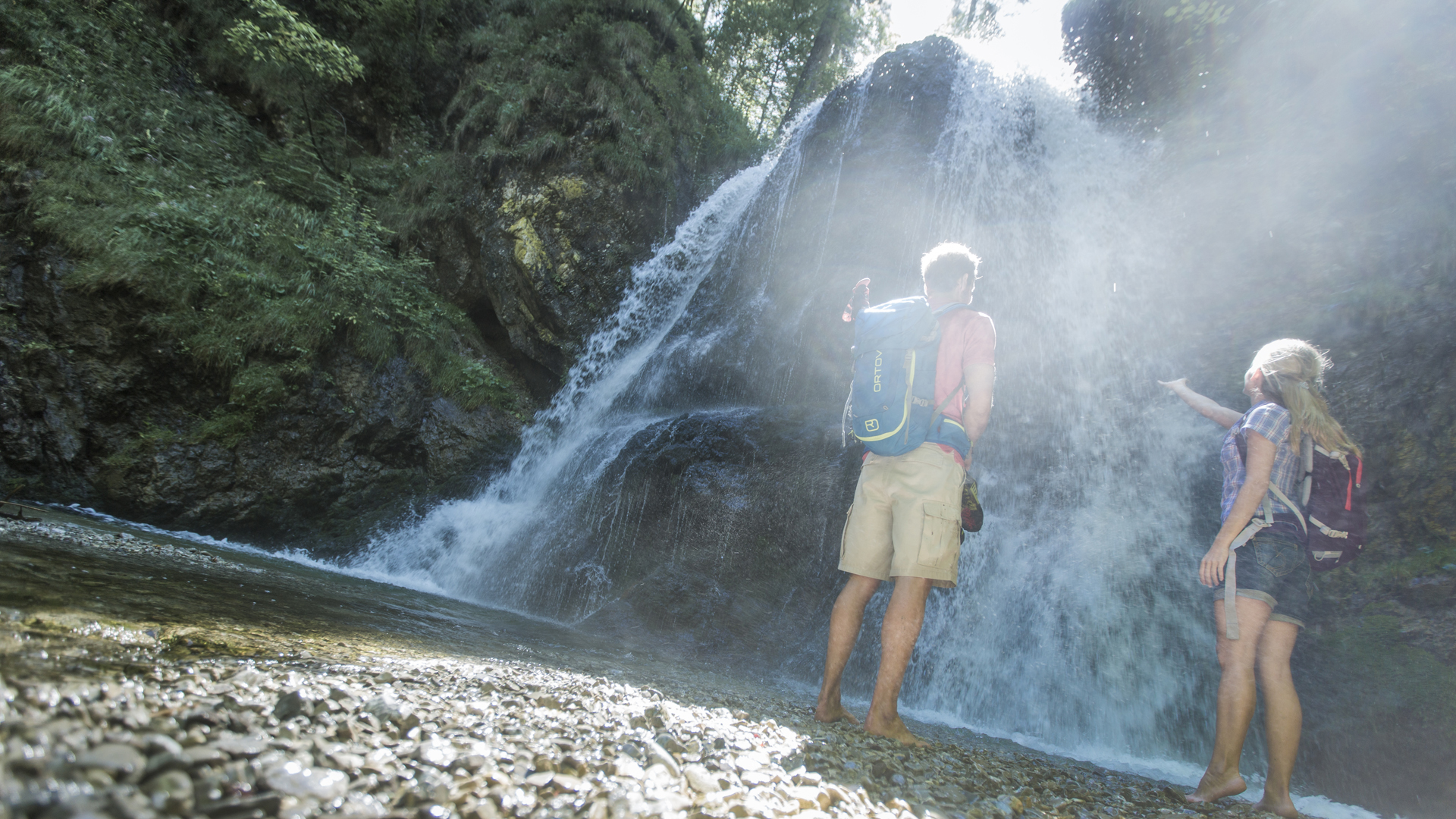
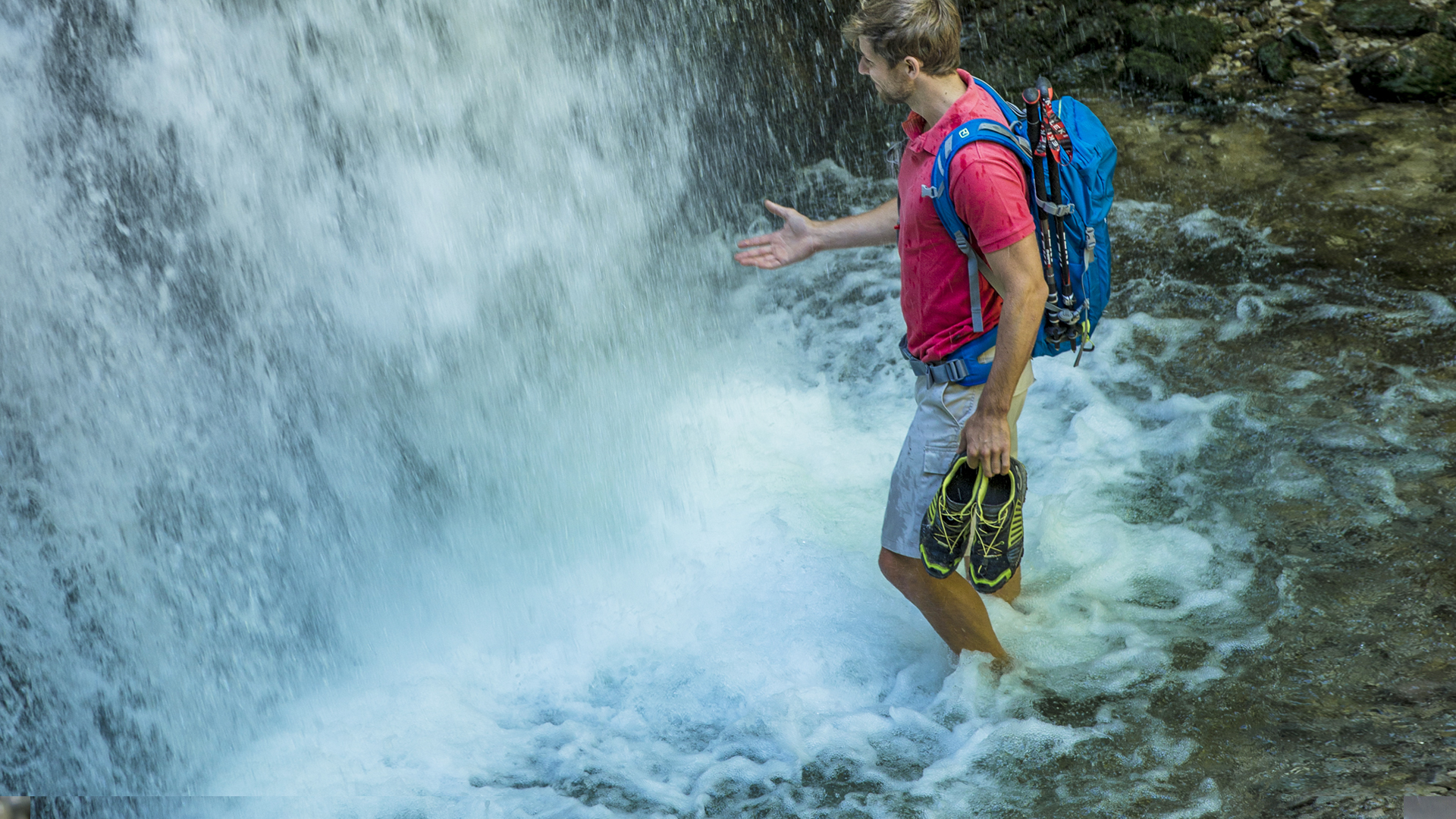
This short moderate walking tour is ideal for families with children. The length of this path has 2,8 kilometres and you will arrive at the waterfalls of Josefstal - a wonderful valley near the lake Schliersee. Especially children and adults will love this track. Hiking maps rate this tour with two stars for condition and for technical skills with three stars. The landscape is astonishing (landscape: four stars) and the highest point is at 952 metres above the sea level, the lowest point is at 810 metres.
The walking path starts and ends at the “Josefstaler Strasse”. This street you will find on the southern side of the Schliersee in Neuhaus. If you are planning to travel by train, jump on the Bayerische Oberlandbahn (BOB) at the main station in Munich. All day long every hour a train leaves to Schliersee / Fischhausen-Neuhaus. You also can travel by car. Just drive along the Autobahn A 8 until you reach the exit to Weyarn. Now follow the state road ST 2072 and the national road B 307. As soon as you see a sign showing you the way to Schliesee/ Fischhausen-Neuhaus, please follow this sign until you arrive at the parking site at the Josefstaler Strasse.
Do not forget to put on your trekking shoes and to pack something to drink and some food for your family tour. In order to avoid sunburns and heat strokes, wear proper clothing and please do not forget your sun cream and head covering. If it is cool and windy, prepare yourself for this kind of weather. In winter, you should take a sleigh with you. All along the old road called “Alte Spitzingstrasse” you find many small hills to run down. All information about the Family to the waterfalls of Josefstal occurs without guarantee. Walking this tour is at your own risk.
Location details:
As soon as you have arrived in Josefstal, please walk along the Josefstaler Strasse until you have reached the last house. Now turn right and walk straight ahead. After approximately 10 minutes, you will hear a murmur nearby. You now also can see the first cataracts. The path will then lead you up the hill. Next to the trail you can see a stream. You will also stop by further cataracts. How about cooling down a bit. Just take of your shoes and enjoy this refreshment.
After this short break, it is time to move on. As soon as you have reached a small clearing with a bridge nearby, you have found the perfect place to enjoy a picnic with your family. Further on you will pass by a mountain pasture called “Stockerlalm” (no service and catering). Here you also can stop for a while until you start going back to the valley. On the left side of the “Stockerlalm” you will find the way back to Josefstal.
Difficulty moderate
Track length in metres 2,8 km
Ascent in metres 155 m Descent in metres 155 m Duration 1:30 h
Lowest point in metres 810 m
Highest point in metres 952 m
Condition **||||
Tekkers ***|||
Adventure *****|
Landscape ****||
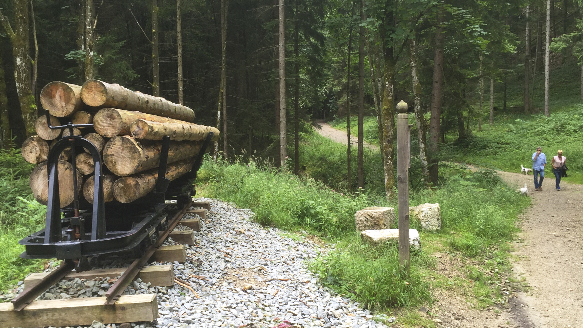
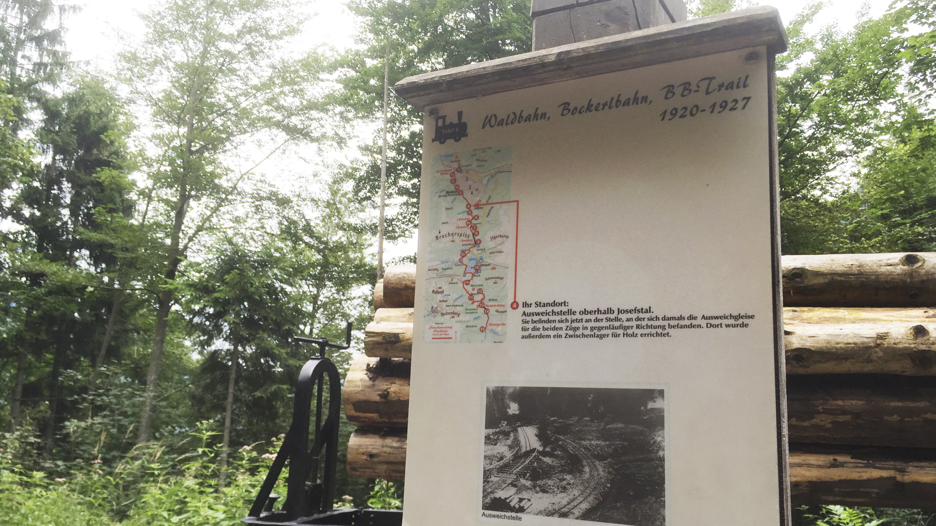
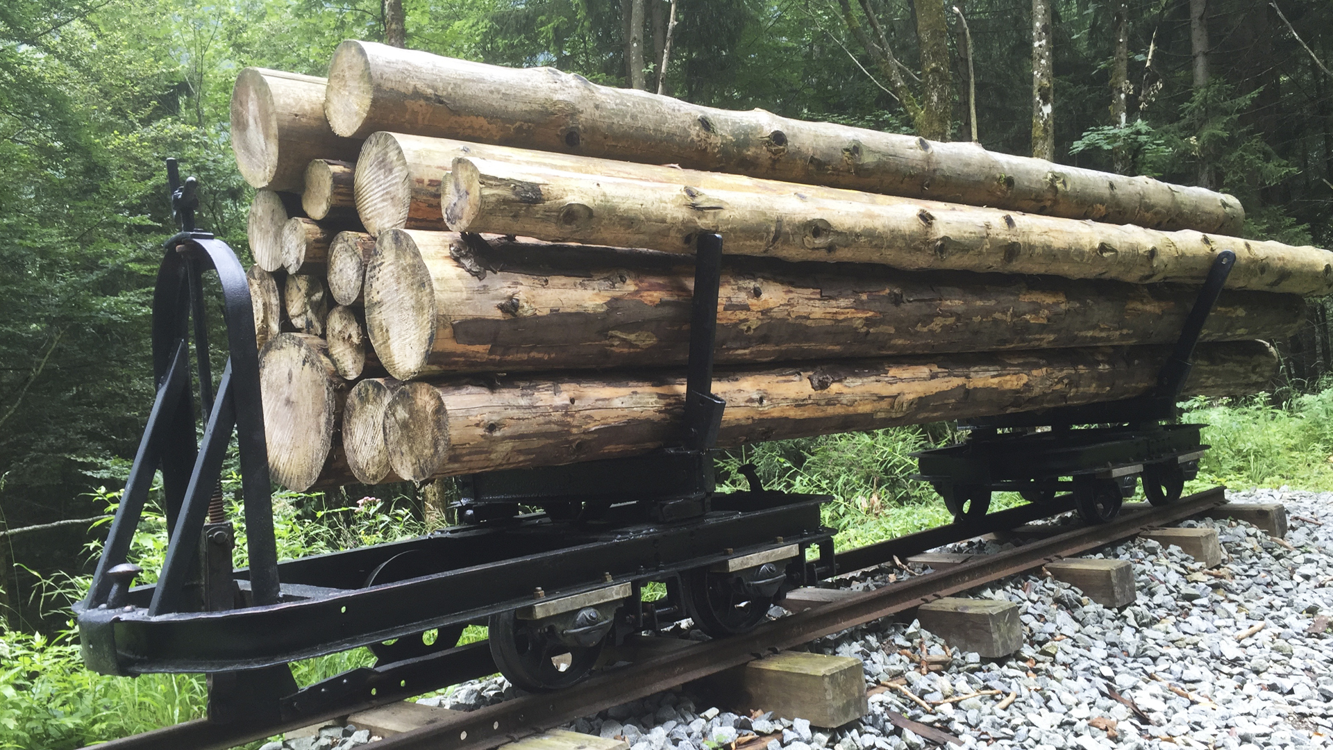
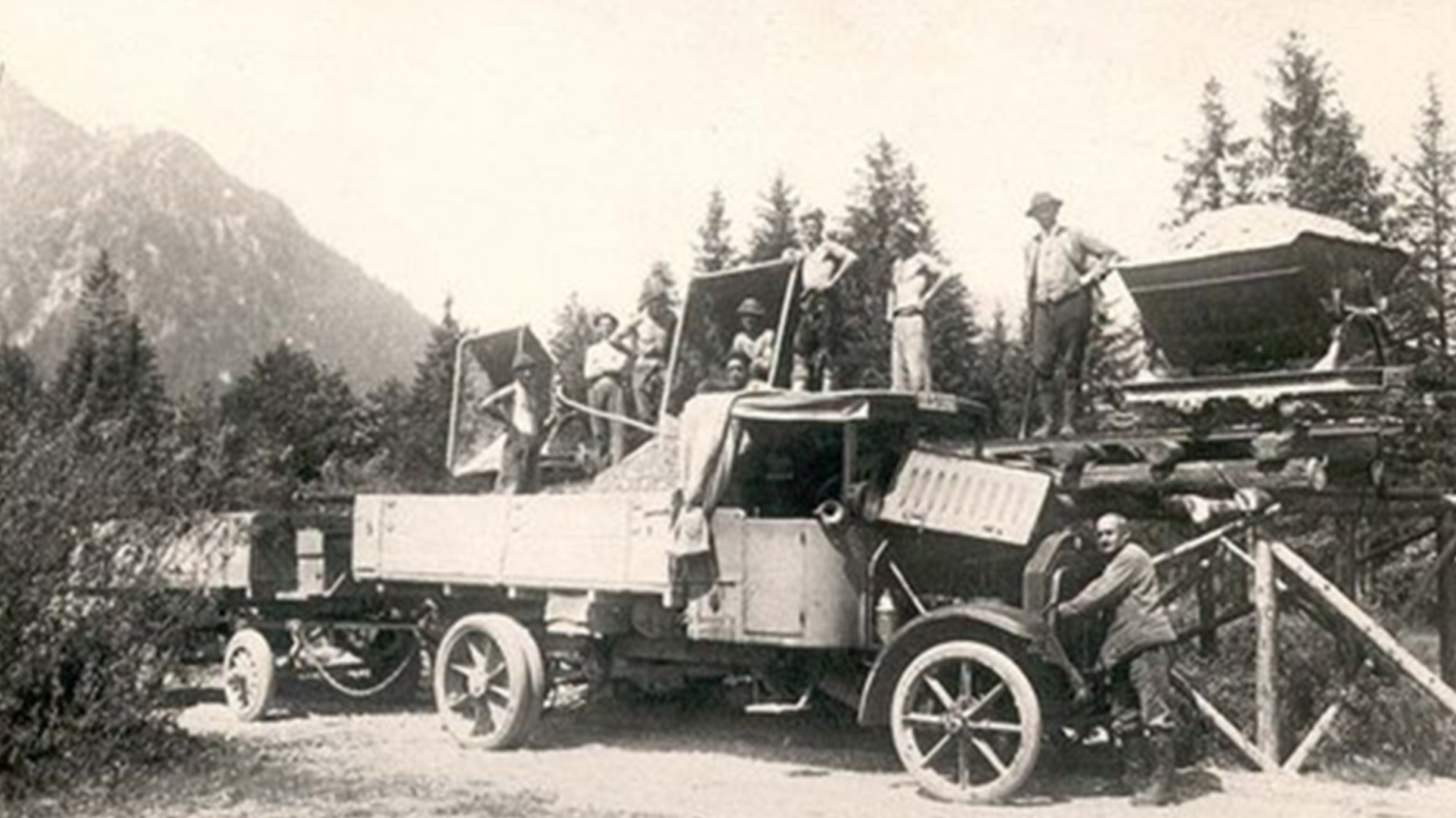
This moderate tour leads along the former track of the so called “Bockerlbahn” to the village Spitzingsee and the same-named lake. The circular walk starts at the main station Fischhausen-Neuhaus and has a length of 12 kilometres. It will take you approximately 3.5 hours to walk back and forth. The lowest point is at 804 metres and the highest point is at 1.134 metres. Hiking maps rate three stars for condition and technical experience. The landscape is classified with four stars, adventure with five stars. Along the way you will find information boards with historic pictures and orientation maps about the course of the track, technical explanations and historic data.
All information about the Bockerlbahn Adventure Trail occurs without guarantee. Walking this tour is at your own risk. Travelling by car, just drive along the Autobahn A 8 until you reach the exit to Weyarn. Now follow the state road ST 2072 and the national road B 307. As soon as you see a sign showing you the way to Schliersee/ Fischhausen-Neuhaus, please follow this sign until you arrive at the parking site at main train station. If you are planning to travel by train, jump on the Bayerische Oberlandbahn (BOB) at the main station in Munich. All day long every hour a train leaves to Schliersee / Fischhausen-Neuhaus. Hikers who do not want to walk all the way back can hop onto the bus (RVO) number 9562 in Spitzingsee and get off in Fischhausen-Neuhaus. All guests who have purchased the Schliersee Guest Card are free of charge for all buses of the RVO driving through the administrative district of Miesbach.
Location details:
During 1919 and 1927 the main station in Fischhausen-Neuhaus was the final stop of the so called “Bockerlbahn”. At that time wood from the Spitzing area was taken away from here. Almost all trees of the area were damaged during a disastrous storm. From this historical place the hiking tour begins. Walk along the “Wendelsteinstrasse” to the “Brecherspitzstrasse”. As soon as you have passed the recycling depot, look for the street called “Bodenschneidstrasse”. You find this street about 200 metres away on the left side. You will find an information board at the “Weindl-Lenz-Strasse”, now walk to the junction and then turn left until you have reached the “Dürnbachstrasse”. After about 150 metres turn left and walk over the bridge crossing the little stream is called “Dürnbach”. Straight ahead you will see a small street on the right side. This is the “Stockeralmweg”. Follow this way and don´t forget to read all the synoptic table with information about the rail track of the “Bockerlbahn”.
As soon as you see the small stream called “Ankelbach”, please walk to the forest. The path will now lead you along a gravel pit and at the end to the junction towards the “Stockeralmweg”. Along the way there are ditches and a sign with information about the third brake incline of the train.
Passing by a meadow you now go up the hill until you see a serpentine road. The alpine hut “Stockeralm is at end of this road. This is where the second brake incline of the train has been. Now it´s the right time to decide to go back or to continue the tour. If you want to go back, just follow the hike path to the “alte Spitzingstrasse”, an old road leading you to the alpine hut “Stockeralm”.
Now follow the stream back through the forest. This path leads you directly along the rail trail and a former ski-run beneath the first brake incline. In a distance of about 250 metres from the information board, on the right side you can see some remains of a basement. These are the remains of the winder station, which lies above the second brake incline.
If you want to continue the walk, you have to go back to the former track, through the forest, until you reach the Alpine meadow of the so called Spitzingsattel. Here you can buy a snack at the kiosk and rest for a while.
The former track of the “Bockerlbahn” will lead you along the “Spitzinghaus”. After you passed by, you then will go by the parking site of the curve lift and later on will walk on the forest road. As soon as you have reached the access road of the Stümpfling chairlift, turn left and walk in the direction of the “Wurzhütte” and Spitzingsee.
1919 all trees which have been damaged during a great storm in Spitzingsee and the surrounding area. The remains of the trees have been prepared by woodworkers and then were transported to the “Bockerlbahn”. An information board at the new Wurzhütte will tell you the whole story. You also can look at some pictures and the course of the tracks. Next to the information board you will find a path which branches off to the right towards the “Rosskopf House”. The road runs on the route of the old train path which was above the mountain pasture called “Valepper Almen”. Later on a rock was blown away and the steam train was able to drive through this opening down the hill to the valley. Further on you will pass by the “Blecksteinhaus”. Maybe you want to do a side trip to the so called “Grünanger”. Just keep on following the path and then walk over the bridge of the “Rote Valepp”. During the time of the “Bockerlbahn” a huge wood storage stood near the “Grünanger”.
Long time ago, an inclined lift transported the wood near the Blecksteinhaus” to the valley. In order to continue the walk, cross the bridge over the “Rote Valepp”. Now you will find an alpine hut called “Aitzinger Alm” - this is terminal point of the “Bockerlbahn” and a former train station. The tarred road leads back you to the Spitzingsee. The footpath takes you approx. 45 minutes.
During the summertime you also can hop on the RVO-Bus at the stop near the “Waitzingeralm”. This bus will take you to Spitzingsee and from there you can catch the Bus to Fischhausen-Neuhaus.
Difficulty moderate
Track length in metres 12,1 km
Duration 3:30 h
Lowest point in metres 804 m
Highest point in metres 1134 m
Condition ***|||
Tekkers ***|||
Advanture *****|
Landscape ****||
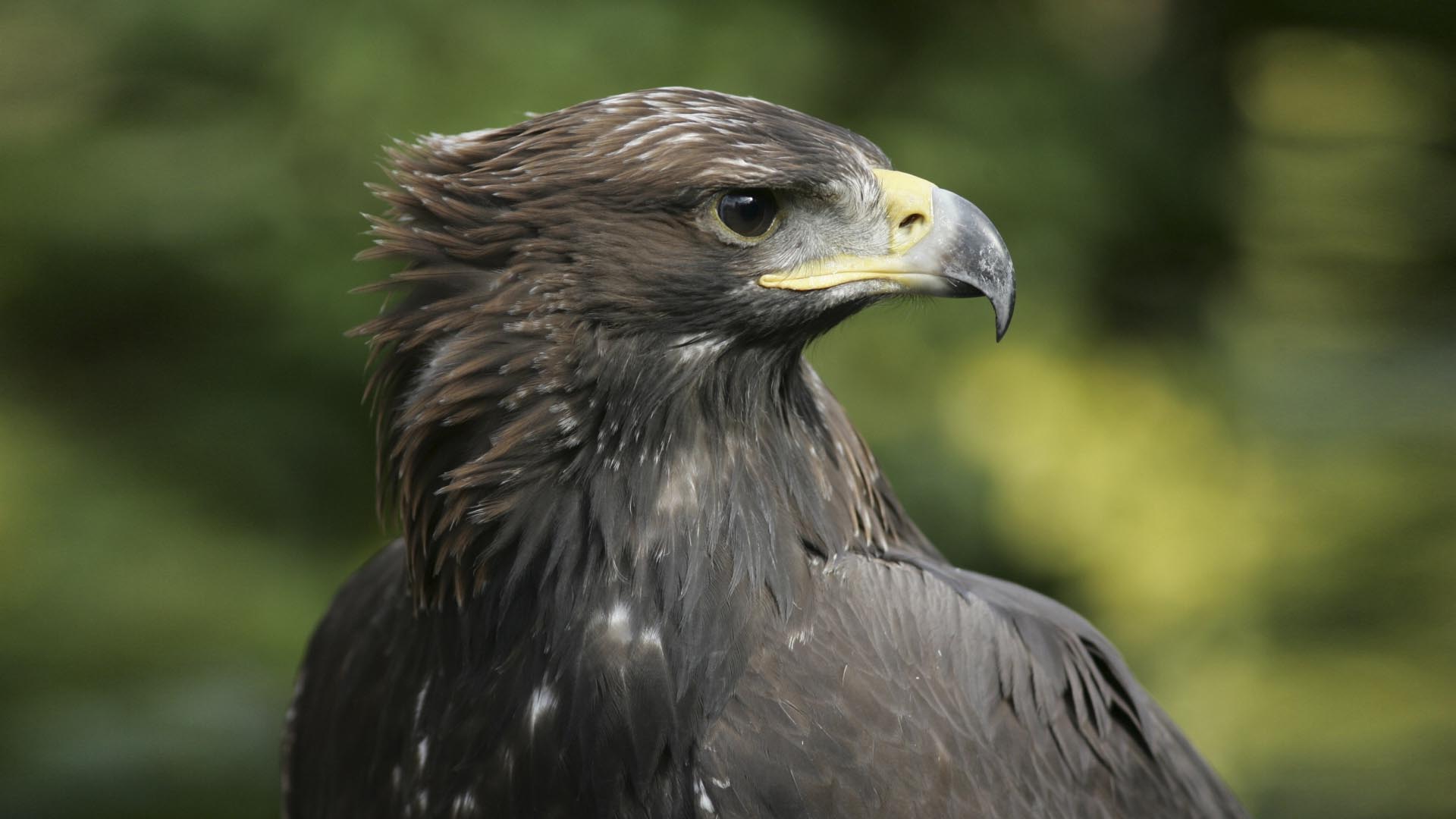
The “Golden Eagle Adventure trail Spitzingsee” is a popular mixed-use path tour of the so called “Natural Family”-fascination area. This moderate tour takes you about two hours and Hiking maps rate adventure with six stars, technique and condition each with three stars. The track is about 2.1 kilometres long and the lowest point is 1.126 metres and the highest 1.419 metres.
The starting point of the tour is the so called Spitzingsattel. The best way to get to Schliersee by car, is to drive on the A 8 and then take the exit to Weyarn. Take the state road ST 2072 and the national road B 307 heading to Schliersee and follow the signs to the state road ST 2077 to Spitzingsee. Shortly before Spitzingsee, you will find the parking site at the Spitzingsattel. The fee costs 4. Euro a day. Travelling by train is very comfortable. Just catch the train from the Bayerische Oberlandbahn (BOB) leaving from the main station in Munich to Bayerischzell. You can catch the train every hour. As soon as you have reached Fischhausen-Neuhaus, it is time to hop off and to catch the bus (RVO) to Spitzingsee. More information about the guided tours to the territories of the Golden Eagle, the exact times of the tours and information about the species protection project, you can find at www.steinadler-info.de.
All information about the Golden Eagle Adventure trail Spitzingsee occur without guarantee. Walking around the Spitzingsee area is at your own risk.
Location details:
As soon as you have arrived at the parking site Spitzingsattel, walk to the sloping meadow and then to the edge of the forest. On the right side you will have a perfect view to the so called “Brecherspitz” and “Bodenschneid”. Underneath the Brecherspitz you can already see some breeding-grounds. Nearby your position is a natural mountain forest. Here the Golden Eagle hunt their prey.
Follow the marked path through the forest until you reach a clearing on the right side of the road. Take a look and enjoy the wonderful sight around you. Afterwards go straight ahead until you reach a fork in the road. Please turn left. After about 50 metres you can see the “Rosskopf” (looks like the head of a horse) and the Stümpfling. Golden Eagles hunt there and they also search for prey at the “Rotwand” and “Taubenstein”. These two rocks you can see, if you look straight ahead.
The last short stage of the adventure trail Spitzingsee leads you around the hillside to the Alpine hut called “Schönfeldalm”. Lots of hiking tours to the top of the mountains “Aiplspitz”, “Rotwand” or “Jägerkamp” start right here.
All around the trail you can sit down and have a rest or prepare a picnic for you and your family. The way back is very easy to find, too. Just follow the path and look out for the signs to the parking site Spitzingsattel.
Difficulty moderate
Tracklength in metres 2,1 km
Ascent in metres 297 m
Descent inmetres 6 m
Duration 2:0 h
Lowest point in metres 1126 m
Highest point in metres 1419 m
Condition ***|||
Tekkers ***|||
Adventure ******
The Pleasure Walk along the „Prinzenweg“ from Schliersee to the Tegernsee is a very interesting tour which takes you about three and a half hours. On a distance of approximately 14.6 kilometres you will see lots of breathtaking sights. Hiking maps rank this moderate tour with three stars for condition and technique, adventure with four stars.
The highest point is at about 1.322 metres, the lowest at 733 metres. All information about the Pleasure Walk along the „Prinzenweg“ from Schliersee to the Tegernsee occurs without guarantee. Walking this tour is at your own risk.
Travelling by train is very comfortable. Hop on the Bayerischen Oberlandbahn (BOB) heading to Schliersee and Tegernsee at the main station in Munich. Trains leave here every hour. All guests who have purchased the Schliersee Guest Card are free of charge for all buses of the RVO driving through the administrative district of Miesbach.
If you prefer travelling by car, drive on the Autobahn A8 and exit at Weyarn. Follow the state road ST 2072 and the national road B 307 to Schliersee. Look for the signs showing you the way to the central station of Schliersee and park there.
Location details:
As soon as you have arrived at the central station in Schliersee, walk to the ice skating area and follow the way to Freudenberg. Cross the bridge over the railroad tracks of the Bayerische Oberlandbahn and then walk to the parking site for hikers near the Hennerer farm. Here is where the so called “Prinzenweg” starts (engl. princes path). From here you will directly be led to the Alpine hut “Kreuzbergalm”. After a short break, it is time to walk to the “Gindelalmschneid” and the Alpine hut called “Gindelalm”. Here you also can rest for a while, enjoy a local snack and then continue your hiking trip. As soon as you have reached the mountain inn Neureuth, you will notice that the path is leading you downwards the hill. After you have passed the Lieberhof farm, the Tegernsee is nearby. At the Tegernsee you can stop for a while in order to eat a Bavarian dish, e.g. at the “Bräustüberl”. Afterwards you can walk the whole way back or you can travel back to Schliersee by train (BOB) or by bus (RVO). Owners of the Schliersee Guest Card are free of charge for all buses of the RVO driving through the administrative district of Miesbach.
Difficulty moderate
Track length in metres14,6 km
Ascent in metres 655 m
Descent in metres 707 m
Duration 3:30 h
Lowest point in metres 733 m
Highest point in metres 1322 m
Condition ***|||
Tekkers ***|||
Advnture ****||
The Pleasure Walk along the mountain peak „Huberspitz“ to the Alpine hut „Gindelalm” is a moderate tour, which is ranked by Hiking maps with four stars for adventure, five stars for landscape, three stars for technical knowledge and four stars for condition. The track length is approximately 12 kilometres. The highest point is at 1.265 metres, the lowest at 762 metres. Ascent and Descent is 575 metres. Alpine boots are recommended for this tour. All information about the Pleasure Walk along the mountain peak „Huberspitz“ to the Alpine hut „Gindelalm” occurs without guarantee. Walking this four hour tour is at your own risk.
The Circular Walk starts and ends at the folk festival area in Hausham. If you are planning to arrive by car, please take the Autobahn A8, exit at Weyarn and then follow the state road ST 2073 to Miesbach and later on the national road B 307 to Hausham. You can park your car at the parking site of the folk festival area. If you prefer to travel by train, the trains of the „Bayerische Oberlandbahn” depart every hour from the central station in Munich.
Location details:
Walk from the folk festival area in Hausham to the little stream called „Schlierach“. Upstream the path will lead you right towards the café Huberalm and then to the mountain peak „Hubertspitz”. Stop for a while and enjoy some regional specialities served here. Afterwards walk down the road, until you reach the hiking path through the forest. This way will lead you directly to the mountain pastures called „Gindelalmen” and the „Gindelalmschneid”. From here you will have a wonderful view to the alpine uplands. Now it is time to go back. On your way, you will pass by the Hennererhof. This is a farm, which offers food and drinks and holiday apartments.
After visiting the farm, keep on walking until you have reached the reservoir. Now turn left onto the so called „Waxensteinweg”. This road on the hillsides leads you directly to the folk festival area in Hausham.
Difficulty moderate, Duration 4:0 h
Track length in metres 11,9 km
Ascent in metres 575 m
Descent in metres 575 m
Lowest point in metres 762 m
Highest point in metres 1265 m
Condition ****||
Tekkers ***|||
Adventure ****||
Landscape *****|
The Pleasure Walk to the „Kreuzbergalm“ and „Gindelalm” is a moderate tour requires a good physical condition (four stars) and provides lots of adventure (four stars). The length of the path is 7.8 kilometres and it takes you about three hours to walk back and forth. The highest point is at 1.321 metres and the lowest point at 859 metres. Ascent and the descent both are 559 metres.
The Pleasure Walk to the „Kreuzbergalm“ and „Gindelalm” occurs without guarantee. Walking this tour is at your own risk. You can travel by train with the „Bayerische Oberlandbahn” from Munich to Schliersee. The train leaves every hour at the central station in Munich. If you prefer travelling by car, please drive on the Autobahn A8 and drive off at the exit Weyarn. Now turn on to the state road ST 2072 and the national road B 307 to Schliersee and park your car at the parking site for hikers near the guest house „Hennerer”. Please call the Guest-Information Schliersee at 08026 60650 in order to receive the opening hours of both Alpine huts
Location details:
Near the parking site for hikers at the guest house „Hennerer”, you will find an information board showing you the way to the „Gindelalm”. Walk up the hill and then through the forest. After approximately one hour, you will see the three buildings - the mountain inn „ Gindelalm”, „Gindelalm 2” and „Gindelalm 3”. Here you can have a break and enjoy some Bavarian specialities. The mountain inn „ Gindelalm” and the Alpine hut „Gindelalm 3” are located on the mountain top. Especially when the weather is very good, lots of hikers and cyclists visit the alpine pasture, enjoy the view and the superb food and service.
Afterwards it is time to walk to the „Gindelalmschneid” and the „Kreuzbergalm“. At the „Gindelalmschneid” you can look at the alpine upland and at the „Kreuzbergalm“ you can take some pictures of the mountain „Wendelstein”. The Alpine hut is located between the „Gindelalmschneid” and the „Kreuzbergköpfl“. In summertime this hut is farmed and guests can try some delicious Bavarian food. The rest of the year only drinks are served.
Now it is time to say „Goodbye” and to walk back to the parking site for hikers near the guest house „Hennerer”. Please follow the information board and choose the „Prinzenweg”. This road will directly lead you to the starting point of this Circular Walk.
Difficulty moderate
track length in metres 7,8 km
Ascent in metres 559 m
Descent in metres 559 m
Duration 3:0 h
Lowest point in metres 859 m
Highest point in metres 1321 m
Condition ****||
Adventure ****||
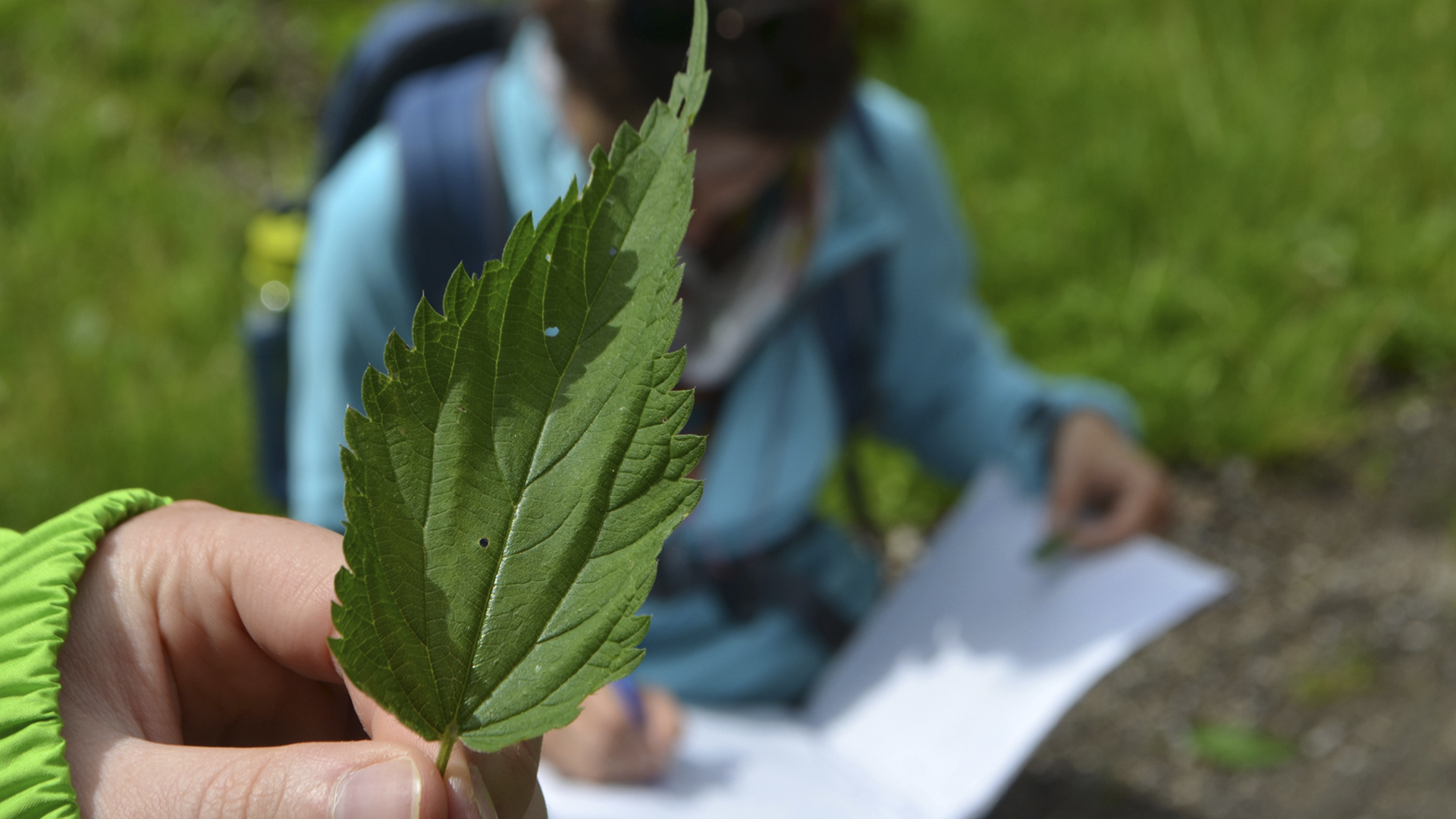
Get to know everything about „wild“ herbs
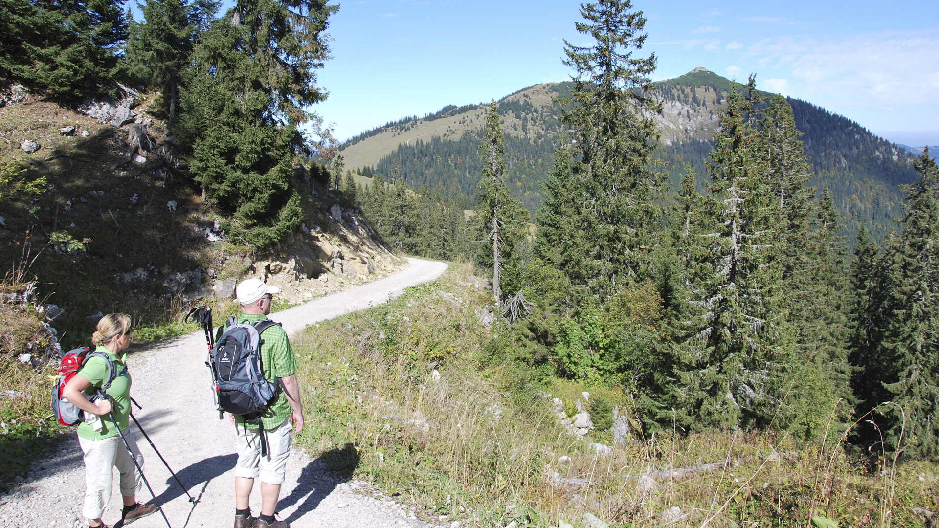
All around the lake Schliersee you will find pure nature! Just take a walk through the mountains, along the lake or through the meadows and forests. You also can discover the beauty of the region by bike or in the snow during the winter season.
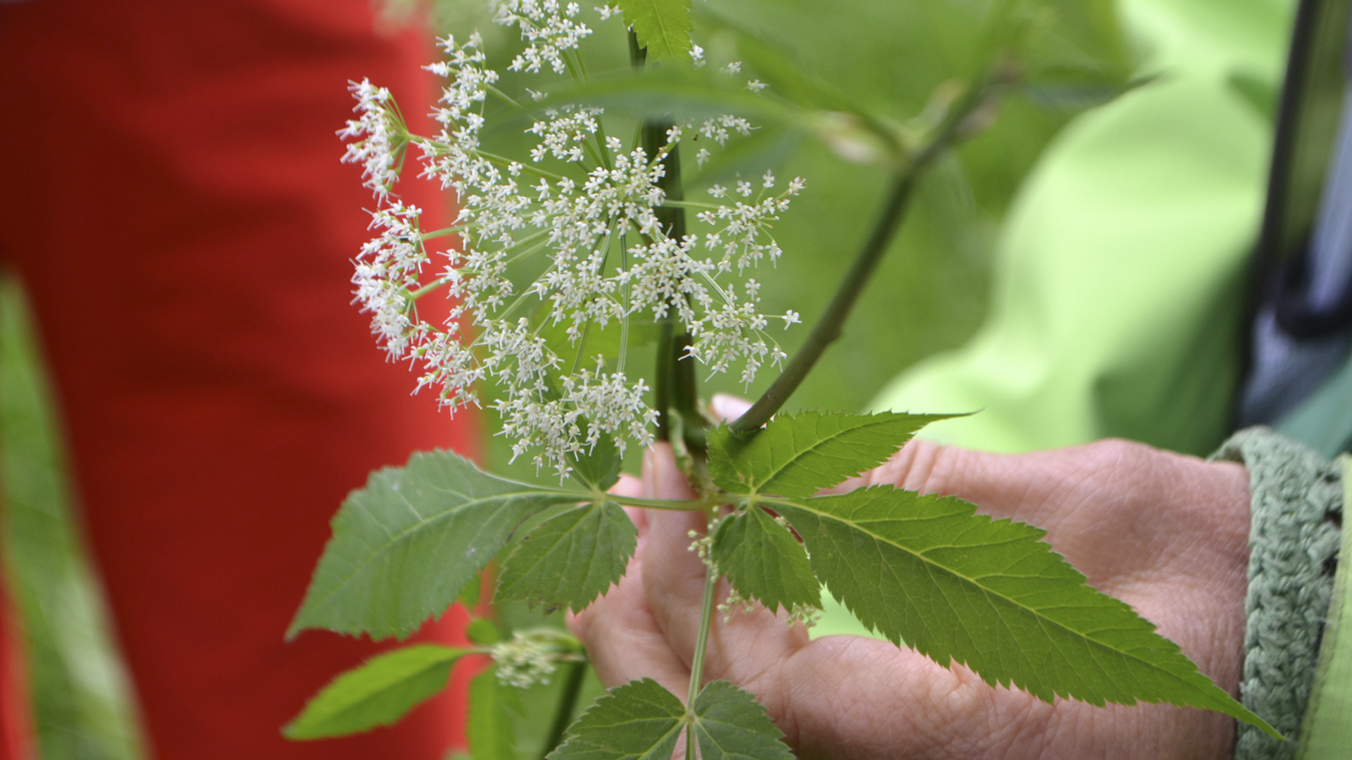
There is so much to be found during a walk through nature. Take a closer look and discover the surrounding flora. Not everything you see are weeds. Especially edible wild herbs are health-promoting, vital and taste very good. The wild herbs experts will show you the best places in order to find those precious plants. They also will show you, how to recognise these and use these herbs.
Christiane Viehweger - certified teacher for herbs
Since 2004 Christiane Viehweger works as certified teacher for herbs and also as a nature and landscape guide. She will show you edible herbs. During the walk, you can touch the plans, smell their leafs, flowers and fruits and you can also try their taste. Christiane Viehweger finds it very important to become more aware of nature and its value. Besides her herbal walking tours she also offers barefoot walking tours.
Christiane Viehweger
Josefstaler Str. 21d
83727 Schliersee /Josefstal
Tel: +49 (0)171 / 7604378 (Mo-Do ab 16.30 Uhr, Fr ab 13 Uhr)
E-Mail: christiane-kraeuter(at)gmx.de
Internet: www.wildkraeuterkuchl.de
Angelika Prem - certified teacher for herbs
Grown-ups and children will learn a lot about wild herbs during a walking tour with Angelika Prem. She will show you around the farm “Hennererhof” and introduce you to the secrets of wild herbs and the natural surroundings.
Hennererhof
Angelika Prem
Hennererstr. 36
83727 Schliersee/Westenhofen
Tel. + Fax: +49 (0) 80 26 / 9 22 99 64
E-Mail: info(at)hennerer.de
Internet: www.hennerer.de
Fesl Margarita - certified teacher for herbs
Explore the energy and the curative effect of wild herbs. Rita Fesl is not only a certified teacher for herbs, she also works as dairy maid and knows a lot about the mysteries of nature.
Kräuterpädagogin Margarita Fesl
Radspielergasse 1, 83727 Schliersee
Telefon +49 (0)8026 6739
E-Mail: rita.fesl(at)t-online.de
All guided herbal wandering tours and more events dealing with the topic „wild herbs” are available inside the Schliersee event guide.
Geocaching is the modern type of treasure hunt and very exciting all participants. You can choose a single cache or a multi cache. During the multi cache you have to answer questions and solve puzzles in order to find the true treasure at the end of the hunt.
The Schliersee region offers lots of single caches. The paths will lead you through Alpine meadows, forests and along other exciting sights and trails. You can find all Geocaches in and near Schliersee at www.geocaching.com.
All important geographic coordinates can be found on the interactive map of the Alpine region Tegernsee-Schliersee. Your GPS-device will show you the best way to reach the final destination of the quest.
During the treasure hunt you will walk through the wonderful landscape of Schliersee and its region. Do not forget to stop once in a while and to take a break, in order to enjoy the sights. Many hideouts are wonderful for having a picnic or to sit down on a bench and to relax for a while.
As soon as you have found the cache and the surprise waiting for you, please enter your name into the log book and place a little present for the next treasure hunter. Also do not forget to visit one of the many restaurants and cafés in Schliersee. This is a wonderful way to round off a successful Geocache.
The tour brochure „Tegernsee - Schliersee - Wendelstein“ was published in 2014 and hikers still reckon this as one of the best set books ever. Never forget to take this brochure with you, of you are planning to tour through Schliersee and its region. On 112 pages you will find 40 tours through the administrative district of Miesbach and short descriptions of each path and its level of difficulty. Accomodation, restaurants, cafés and all opening hours are noted on the hiking map.
The hiking map on a scale of 1: 30.000is tearproof and waterproof and fits in every trekking backpack. Regardless of wether you are planning a mountain tour, a walk through the valley or a tour from lodge to lodge - this brochure will help you in every situation. The tour brochure and map „Tegernsee - Schliersee - Wendelstein“ is available for 7,50 Euro at the Guest-Information Schliersee (Vitalwelt Schliersee, Perfallstr. 4). For owners of the guest card the hiking map only costs 6,00 Euro.
You always can book a private hiking and mountain guide for a one day or several days hiking tour. Georg Schindler (Phone number +49 (0)8026 921454) or Jürgen Koschyk (Phone number +49 (0)8026 7766) are both well experienced hiking and mountain guides and will gladly show you around.
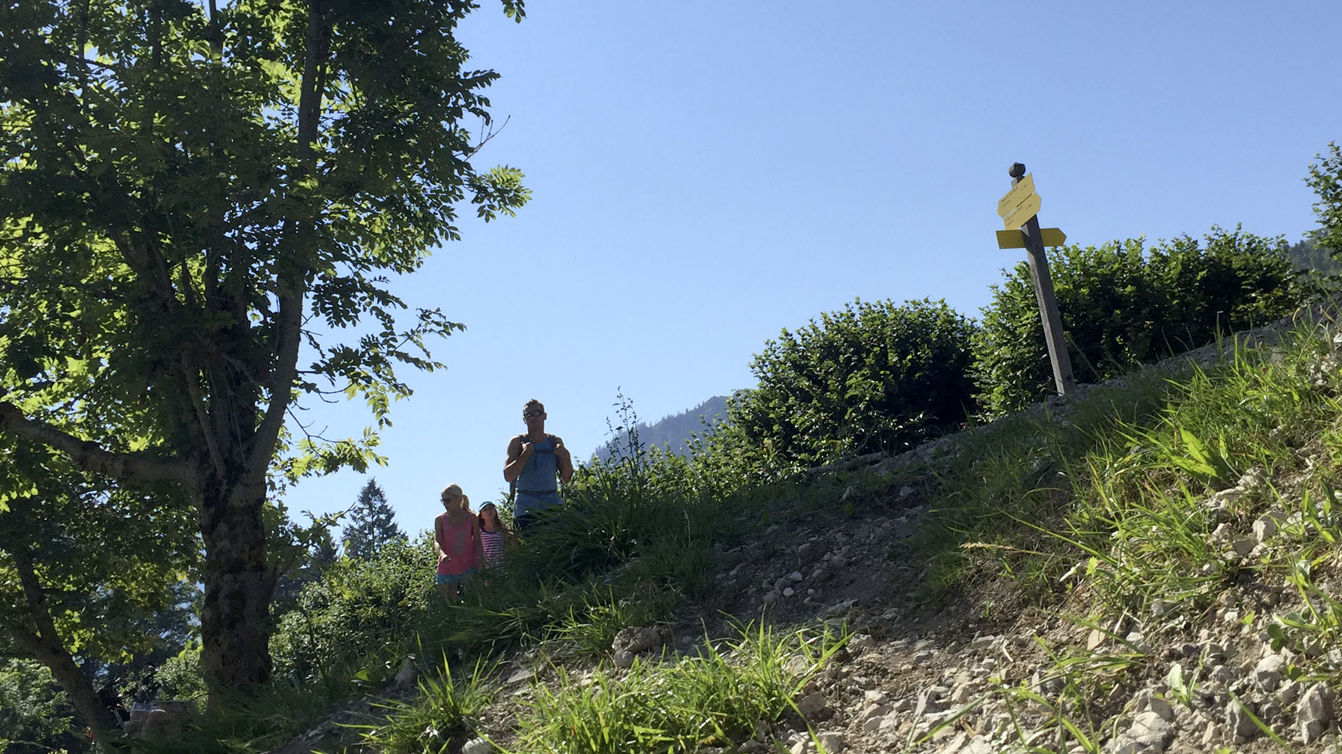
Important note! Please do not forget to wear proper shoes and appropriate clothing during a trekking tour. Also carry enough fluids and food with you and make sure to wear a hat or headscarf and to regularly apply sun cream onto your skin. Please make sure to carry your mobile phone with you, so that you always have the possibility to call the emergency in dangerous situations. Before you start your tour, check the weather forecast or get in touch with the Guest-Information Schliersee.
This Challenging tour is a circular tour from the mountain station at the so called „Taubensteinbahn”, the funicular at the lake Spitzingsee, to the mountain “Rotwand”, “Rotwand Reibn” and back. This moderate tour will take you about three hours and thirty minutes (Tekkers: four stars, Adventure: five stars).
The length of the whole path is 8.3 kilometres. The highest point is at 1.881 metres and the lowest point at 1.497 metres. All information about the Circular Walk „Taubensteinbahn”, “Rotwand”, “Rotwand Reibn” occur without guarantee and is at your own risk
The starting and ending point of the tour is the mountain station „Taubensteinbahn“ next to the lake Spitzingsee. You can get here by car or via public transport. Just drive on the Autobahn A 8 from Munich to Salzburg and exit at Weyarn. Then turn to the state road ST 2072 and the national road B 307 and as soon as you have reached Schliersee, choose the state road ST 2077 to Spitzingsee. Park your car at the parking site of the lower station of the „Taubensteinbahn Spitzingsee” (subject to charge). If you are planning to drive back to the lower station by funicular, the parking fee will be refunded.
The train of the „Bayerische Oberlandbahn” leaves from the main station in Munich to Fischhausen-Neuhaus every hour. In order to get to the lake Spitzingsee, just take the RVO-Bus 9562.
Location details:
Near the mountain station „Taubensteinbahn“ you will find a path leading you to the east side of the mountain „Taubenstein“. Now follow this way up the hill and enjoy the panoramic view to the „Brandenberg Alps“. Afterwards you will walk over the „Lempersberg hill“, the „Kirchsteinsattel“ to the „Rotwandhaus“. Now it will take you approximately thirty more minutes until you have reached a height of 1.884 metres. You now are on top of the „Rotwand” - the highest mountain of the region and the most popular local mountain near Munich.
Enjoy your stay, before you walk back to the „Kümpflscharte” and the valley called „Grosstiefenthal”. Nearby you will see the „Grosstiefenthalalm” - an Alpine hut. From here you can take a short sidetrip to the lake „Soinsee”. This walk will take you about thirty minutes.
Further down the road in the valley “Grosstiefenthal” you will be led along the „Miesingsattel” and then to the valley „Kleintiefenthal”. If you want to expand your walk, just walk onto the „Miesing” and then follow the path to the „Taubensteinhaus” and the mountain station.
Difficulty moderate
Track length in metres 8,3 km
Duration 3:30 h
Lowest point in metres 1497 m
Highest point in metres 1881 m
Condition ***|||
Tekkers ****||
Adventure *****|
For this moderate three hour tour requires a high degree of endurance, physical fitness and experience (Condition: five stars, Tekker: three stars). The path from Lake Spitzingsee to Mount Bodenschneid is 8.7 kilometres long. During the trip you will enjoy the wonderful view (Landscape: five stars) on an adventurous journey (Adventure: five stars). The highest point is at 1.655 metres and the lowest point at 1.106 metres. All information about the Athletic tour from Lake Spitzingsee to Mount “Bodenschneid” occurs without guarantee. Walking this tour is at your own risk.
The starting point of the tour is at the parking site of the Spitzingsattel. If you are travelling by car, please drive on the Autobahn A 8 and drive off at Weyarn. Then follow the state road ST 2073 and the national road B 307 to Schliersee and then turn to the state road ST 2077 to Spitzingsee. As soon as you have reached the parking site Spitzingsattel, you can park there (fees apply).
The trains of the Bayerische Oberlandbahn are a very comfortable way to travel. Every hour the train leaves from Munich and takes you directly to Fischhausen-Neuhaus. Here you can then hop onto the RVO-Bus number 9562 to Spitzingsee. Please ask the bus-driver to let you get out at the bus stop Spitzingsattel.
Location details:
You will find the path called “Stümpflingweg” directly at the parking site Spitzingsattel. After a few minutes, you then will pass the parking site of the curve lift. No walk alon the “Kratzerweg” to the “Untere Firstalm”. On the right side of the “Untere Firstalm” you will find a well-maintained path which will lead you to the “Suttenstein”. Nearby you will find a sign. This will show you the way to the “Bodenschneid”. After a short walk through the forest, you suddenly will have a wonderful view over the mountains. The road to Bodenschneid will become narrower during your walk and at the end you finally will reach the top of the mountain.
Now it is time to walk back to the parking site „Spitzingsattel“. Walk towards the steep track to the “Bodenschneidhaus”. Walk along the right side of the building and then further on to the “Obere Firstalm” and the “Untere Firstalm”. Now follow the “Kratzerweg” and after a few minutes, you will arrive at the parking site “Spitzingsattel”.
Difficulty moderate
Track length in metres 8,7 km
Duration 3:0 h
Lowest point in metres 1106 m
Highest point in metres 1655 m
Condition ****||
Tekkers ***|||
Adventure *****|
Landscape *****|
This mountain hike is very challenging. Especially experienced hikers will love this six hour walk. The path is 17.6 kilometres long and you need a high degree of endurance, physical fitness and experience (Condition: four stars, Tekker: five stars). Hiking maps rank the landscape with six stars. The adventurous journey is rated with five stars. The highest point of the tour is at 1.885 metres, the lowest point at 938 metres. All information about the athletic tour from Lake Spitzingsee to Mount “Rotwand” occurs without guarantee. Walking this tour is at your own risk.
The tour starts in Spitzingsee. Just stay on the Autobahn A 8 from Munich to Salzburg and exit at Weyarn, if you are travelling by car. Then follow the state road ST 2073 and the national road B 307 to Schliersee and Neuhaus. Look for the sign showing you the way to the state road ST 2077 to Spitzingsee. Park your car at the parking site in Spitzingsee (fee required).
Another way to travel to Spitzingsee is by train. Hop on the train in Munich and get off in Fischhausen-Neuhaus. At the bus stop in Fischhausen-Neuhaus, please look for the RVO-Bus number 9500 and ask the bus driver to let you out at the “Watzingeralm”. This way you can save a few metres walking from Spitzingsee and start from here.
Location details:
In Spitzingsee, look for the path to the Alpine hut called „Valepper Alm“. Now walk to the “Blecksteinhaus” and from there down the stream to the “Waitzinger Alm”. Here you will find the way to the “Rotwand”. Afterwards you will pass by the “Pfanngraben”, “Kümpfelalm” and at the end of your little journey, you will reach the “Rotwandhaus”.
Now it is time to take a deep breath and to carry on walking. As soon as you have reached the top of the mountain “Rotwand”, you will be rewarded for your effort with a breathtaking panoramic view of the region of Schliersee.
On your way back, please do not forget to stop by at the „Rotwandhaus“. Here you can take a break and enjoy a nice Bavarian meal.
Afterwards just follow the large path down the hill. Amongst others, you will pass the Alpine Hut called “Wildfeldalm” and a few minutes later the village Spitzingsee.
Difficulty tough
Track length in kilometres 17,6 km
Duration 6:0 h
Lowest point in metres 938 m
Highest point in metres 1885 m
Condition ****||
Tekkers *****|
Adventure *****|
Landscape ******
Experienced hikers will love this six hour circle tour from Aurach to the mountain top of the “Jägercamp”. This very athletic walk is very tough and you need a good physical condition (Condition: five stars) in order to manage the tour. The path is 12 kilometres long and very exciting (Adventure: four stars). The highest point is at 1.737 metres, the lowest at 775 metres. All information about the athletic tour from Aurach to Mount “Jägerkamp“ and back occurs without guarantee. Walking this tour is at your own risk.
The tour starts in Fischbach-Aurach. Come here by car or by train. The train of the Bayerische Oberlandbahn leaves every hour from Munich to the main station in Fischbach-Hammer. From here you then can walk to the starting point.
If you are travelling by car, drive on the Autobahn A 8 from Munich to Salzburg and exit at Weyarn. Then take the state road ST 2073 and the national road B 307 to Schliersee and Fischbachau-Aurach.
Location details:
Start the tour in Fischbachau-Aurach and look for the way to the little chapel. Then follow the road to the mountain “Jägercamp”. Walking up the hill is very challenging. You will walk on a few twisting roads, until you have reached the Alpine hut called “Benzigalm”. Choose the path on the right side and walk to the mountain saddle and then to the Alpine hut “Jägerbauernalm”. The way to the left will lead you to the top of the mountain. Enjoy your stay up there and if you want to see some more, walk further on to the “Aiplspitz”, the peak of the mountain. Only very experienced hikers are recommended to walk this route. It is very challenging and you must be a sure footed climber and with no fear of heights.
Going back to Fischbachau-Aurach you will pass by the “Jägerbauernalm” and then only have to follow the forest road.
Difficulty tough
Track length in kilometres 11,9 km
Duration 6:0 h
Lowest point in metres 775 m
Highest point in metres 1737 m
Condition *****|
Adventure ****||
Not only hikers and cyclists have a good time in the region of Schliersee, also enthusiastic climbers will love this place. Go fetch your climbing equipment and start to take the „Ruchenköpfen“ by storm. This mountain is 1.805 metres high and you can climb two different ways. One starting point is at the valley station Taubenstein in Spitzingsee or you can choose the one at the Alpine hut „Wurzhütte” at the lake Spitzingsee.
At the valley station Taubenstein in Spitzingsee, please walk around the building and walk on the path leading you to the „Rotwandhaus”. You will pass the „Lempersberg”, the so called „Kümpflscharte” and at the northern face you will see the „Auerspitz”. Northbound you will then arrive at the „Brotzeitstein” next to the „Ruchenköpfen”. This tour will take you about 1,5 hours to walk.
The second route starts at the „Wurzhütte”. Walk on the tarred forest road until you pass by a sign showing you the way to the „Rotwandhaus”.
Going back - just walk the normal road (3). From there you will be guided to the actual starting point of your tour.
The „Rotwandhaus“ is farmed all year long and offers accommodation. It is situated at an altitude of 1.737 metres. During the opening hours, y can stop by any time for a Bavarian „Brotzeit” and enjoy a cool drink.
Overview of the route selection:
Untere und Obere Westwand – Alter Riss (5-) in Verbindung mit Bayerländerriss (6-); Südwand – Südwestkante (4+), Südwandplatte (6), Neue Südwand (4-), Dülferriss (4+), Münchner Riss (3+)
If you are planning to climb a few mountains, during your stay in the region of Schliersee - do not miss visiting the so called „Plankenstein“. From here you will have a wonderful view to the surrounding mountains, the forests and to the valley.
The „Plankenstein“ is at a height of 1.768 metres and you also can climb here in winter. Before you start, please watch out for the weather and avalanche forecasts.
The parking site is at the „Wildbachhütte” in the valley called „Valepp”. In order to get there, drive on the road from Enterrottach via the toll way to the Valepp valley. After you have parked your car, walk the forest road to the „Risserkogel” and „Plankenstein“. At the junction (number 1064) turn left and walk by the Alpine hut „Siebalm”. Afterwards you will pass some Alpine meadows and then will reach the mountain saddle called „Riederecksattel”. You now have reached the height of 1.534 metres. From here walk further to the „Plankensteinsattel” and after about 1.5 hours you will walk along the northern slope of the „Risserkogel”.
There several routes to choose from:
Plankensteinnadel – Westkante (7-)
Plankenstein-Westseite – High Noon (7)
Südwand – Vorgipfel-Südwand (5+)
all routes at the southern face of the third chain of alps called „Ostgratturm” (6 to 8); Ostgrat (4+)
You can rope down the „Plankensteinnadel”. It is about 20 metres from the top of the wind gap between the bottleneck and the massif. After that you will go down hill and pass the gap to the west side of the rock.
If you want to climb down from the „Plankenstein“, traverse to the mountain top. Chose the main road and from there go to the western side of the rock. Rope down at the third east ridge of the mountain.
Hiking lovers from all over the world enjoy discovering the exciting routes near lake Schliersee. They also love to plan multi day tours on some sections of the European Long Distance Trail E4. Even some sections of the violet coloured Via Alpina can be found in the region of Schliersee.
If you are planning to walk along some of the E4-sections, please take your time and make sure to plan the exact route before starting the tour. The road will lead you to the „Fockenstein”, „Bad Wiessee” and „Tegernsee”. On the other sied of the lake you can walk to the „Schliersee”, the „Auracher Köpferl”, „Fischbachau”, „Wendelstein” and the Alpine hut „Mitteralm”.
The Via Alpina is located a little more south than the European Long Distance Trail E4. From this road you can walk to the „Brünnsteinhaus”, the mountain „Rotwand”, lake „Spitzingsee and then to the „Stümpfling” via „Sutten” to the „Risserkogel” until you have reached the smal town called „Kreuth”. Afterwards the path will lead you to the Alpine hut „Rauheck Alm” and the „Lenggrieser Hütte”.
It is also possible to interlink these hiking routes. The tour called „Alpine 8.000 Höhenmeter“ (Alpine with a height of 8.000 metres)will take you six days and you will walk about 100 kilometres. During this tour, you will walk through the hiking region of the Alpine region Tegernsee-Schliersee.
Via Alpina hikers will find several accommodation options all over the Spitzingsee area.
From June until October it is possible to hike through the region of Schliersee and to stay over night at one of the Alpine huts of the Alpine Club. The cottages are surrounded by nature and not only accommodate overnight guests, but also day trippers, who want to rest for a while and enjoy something to drink and to eat.
In order to manage a hiking tour from lodge to lodge, you need a very good physical condition, should not be afraid of heights and sure-footed. Depending on your fitness level, you have a broad choice of tours with different kinds of difficult levels.
Before starting your tour, please make sure to plan every single step and book your overnight accommodation on time. During high season many Alpine huts are booked out.
Here you can find a list of lodging houses for your hiking tour. Please contact the owners or carriers of the Alpine huts. They gladly will help you to develop a suitable plan for your tour.
List of lodges and Alpine huts around the region of Schliersee and Spitzingsee:
Schönfeldhütte
Spitzingsee
83727 Schliersee
Phone:+49 (0)8026 71264
E-Mail: info(at)schoenfeldhuette.de
Internet: www.schoenfeldhuette.de
Kreuzbergalm
83727 Schliersee
Albert Link Hütte
Valepperstr. 8
83727 Schliersee
Phone:+49 (0)8026 71264
E-Mail: info(at)albert-link-huette.de
Internet: www.albert-link-huette.de
Taubensteinhaus
Spitzinggebiet
83727 Schliersee
Phone:+49 (0)8026 7070
Internet: www.taubensteinhaus.de
Berggasthof Untere Firstalm
Kratzerweg
83727 Schliersee
Phone:+49 (0)8026 7676
Internet: www.untere-firstalm.de
Bodenschneidhaus
Bodenschneid 1
83727 Schliersee
Phone:+49 (0)8085 3899998
Mobile: +49(0)1728502147
E-Mail: info(at)bodenschneidhaus.de
Internet: http://bodenschneidhuette.bayern/index.html
Jagahüttn am Stümpfling
Spitzinggebiet
83727 Schliersee
Phone:+49 (0)8026 925155
E-Mail: jagahuettn(at)t-online.de
Internet: www.jagahuettn.de
Obere Maxlraineralm
Spitzingseegebiet
83727 Schliersee
Phone:+49 (0)8026 7382
E-Mail: info(at)obere-maxlraineralm.de
Internet: obere-maxlraineralm.de
Berggasthof Klausenhütte
Roßkopfweg 2
83727 Schliersee
Phone:+49 (0)8026 71807
E-Mail: klausenhuette(at)t-online.de
Internet: www.klausenhuette.de
Berggasthof Obere Firstalm
Trautweinweg
83727 Schliersee - Spitzingsee
Phone:+49 (0)8026 7302
E-Mail: info(at)firstalm.de
Internet: www.firstalm.de
Berggasthof Blecksteinhaus
Am Bleckstein 1
83727 Schliersee
Phone:+49 (0)8026 71204
E-Mail: blecksteinhaus(at)t-online.de
Internet: www.blecksteinhaus.com
This moderate tour from the mountain saddle called Spitzingsattel to Rottach will take you four days (approximately 18 hours). The route is about 40 kilometres long and during the way up and down the mountain, you will leave 2.787 metres behind you. The highest point is at 1.790 metres and the lowest point at 775 metres. Hiking maps rate physical condition and tekker with each four stars. Adventure and landscape are rated with each six stars.
In order to manage the whole hiking tour, it is necessary to be prepared properly. You need good equipment, e.g. mountain boots, hiking sticks, food and first aid equipment. All information about the 4-day- hike from lodge to lodge - from Spitzingsattel to Rottach occurs without guarantee. Walking this tour is at your own risk.
This four day tour starts and end at the mountain saddle called Spitzingsattel. You can travel by car by driving on the Autobahn A 8 from Munich to Salzburg. Exit at Weyarn and then follow the state road ST 2073 and the national road B 307 to Schliersee. In Schliersee, please look for the signs to Spitzingsee. At the parking site Spitzingsattel you can leave your car (fee required).
It is also possible to travel by train. The Bayerische Oberlandbahn will take you from Munich to Fischhausen-Neuhaus. The train leaves every hour. As soon as you have reached Fischhausen-Neuhaus, hop on the RVO-Bus number 9562 to Spitzingsee and get off at the Spitzingsattel.
Location details:
Day 1: Tour from the Spitzingsattel to the Rotwandhaus
At the „Spitzingsattel” walk up the hill to the „Schönfeldalm” and the „Taubenstein”. Now you have reache a height of 1.600 metres. Follow the „Panoramaweg” straight up to the „Rotwandhaus” and the mountain called „Rotwand”. You have now accomplished the first stage of the tour. Have a nice stay and enjoy your sleeping accommodation.
Day 2: Tour from the Rotwandhaus to the Bodenschneidhaus
After a nice breakfast, you will start the second stage of the hiking tour. Run down the hill until you have reached the forest road. This road will lea you to lake Spitzingsee. Just go downstream on the waterside of the stream „Valepp” and look for the Alpine hut „Albert-Link-Hütte”. Here you will find the way to the mountain „Stolzenberg”. Follow the steep path to the „Haushamer Almen“ and the „Stolzenberg“. As soon as you have climbed up to the mountain top, you can see all the beautiful sights of the region of Schliersee. Further on, you will walk along the „Rotkopf“, pass by the „Jagahüttn”, „Suttenstein” and „Bodenschneid”. Now it is time to check in the „Bodenschneidhaus”. Here you will stay over night.
Day 3. Tour from the Bodenschneidhaus to Enterrottach
On the third day of your hiking tour, you first will walk back along the „Bodenschneid” to the „Bodenalm”. After a short break, please walk along the hiking path and stop at the tollbooth in Enterrottach and enjoy your stay at the lodge.
Day 4: Tour from Enterrottach to Spitzingsattel
On the last day of the tour you will first walk to the north towards „Kühzagl”, then turn right and up the hill to the „Kühzaglalm”. If you see some cows grazing on the meadow, visit the Alpine hut and enjoy a Bavarian „Brotzeit” and something to drink. Afterwards it is time to leave to the „Untere Freudenreichalm”. Here you also can sit down, stay for a while and eat something.
In order to reach the forest road, walk up the hill to the „Obere Firstalm”. From here just walk along the way and at the end you will arrive at the „Spitzingsattel”. This last stage of the tour will take you about 40 minutes.
Difficulty moderate
Track length in kilometres 39,9 km
Duration 18:00 h
Lowest point in metres 775 m
Highest point in metres1790 m
Condition ****||
Tekker ****||
Adventure ******
Landscape ******
During this four day tour, you will walk from Fischbachau to the so called „Kesselalm” in Bayrischzell, the „Rotwandhaus” and back. This 18 hour hike is very challenging (Tekker: four stars) and only suitable for experienced hikers (Condition: five stars). On a distance length of 40.6 kilometres you will have a terrific view (Landscape: five stars). Adventure is rated with five stars in hiking maps. The reason is not only walking on sealed and built out roads, but also through open and rocky areas. All information about the 4-day- hike from lodge to lodge - Wendelstein and Rotwand occurs without guarantee. Walking this tour is at your own risk. The highest point of the tour is at 1.868 metres and the lowest at 770 metres.
In Birkenstein, opposite to the pilgrimage chapel, you can park your car. In order to get there, drive along the Autobahn A8 an exit at Weyarn. Then follow the state road ST 2073 and the national road B 307 to Fischbachau.
It is also possible to travel by train. The Bayerische Oberlandbahn will take you from Munich to Fischbachau-Hammer. Here you then can get on the RVO-Bus number 9552 to Fischbachau-Birkenstein. If you like, you also can walk from Fischbachau-Hammer to Birkenstein.
Please do not forget to carry Standard clothing for high mountain walks, solid hiking boots, wind- and waterproof outer layer, a day pack with food and beverages, a first-aid-kit, as well as a warm jumper, a hat and mittens.
Location details:
Day 1: Travelling from Fischbachau to the Alpine hut „Kesselalm”
Walk the narrow forest path from Fischbach to the „Kesselalm”. All along your way, you will walk through a forest and later on through cleared areas. As soon as you have reached the „Kesselalm”, stop by at the little chapel called „Kircherl” and enjoy the wonderful landscape. Now you can take up your quarter for the night and if you like, you also can take a short walk to the mountain called „Breitenstein”.
Day 2: Tour from the Kesselalm to Bayrischzell
The second day of the hiking tour starts at the Kesselalm. Walk towards the mountain „Wendelstein” and as soon as the path gets more and more narrow, a steep ascent leads you to the southern flank of the mountain and then further on to the top station of the ropeway. It is time to take a break and to recover for a while. Afterwards one of the most exhausting parts of the tour starts - the way to the top of the mountain. Nearby are also the GeoPark Wendelstein, a cave and the rack railway to be found. If you want to relax, just hop on the ropeway. In a minimum of time you will then arrive in Osterhofen. Needless to say, you can also walk there. Along the way you will pass by the „Zeller Scharte”, the „Wendelsteiner Almen” and „Hochkreuth”. As soon as you have reached Bayerischzell, you have managed the second part of the four day trip. Have a wonderful time in your hostel.
Day 3: Walking from Bayrischzell to the Rotwandhaus
During the third day of the tour, you will need lots of strength. The road will lead you all the way up the hill towards Seeberg. You will pass the „Neuhüttenalm” and the „Niederhoferalm”. Look for the road to the lake Soinsee and the mountain Rotwand. Enjoy hiking through the woods, through open and rocky areas. Rest a little while at the Soinsee and have a snack. Afterwards you will walk along the riverside in the south of the so called „Ruchenköpfe”. As soon as you have reached the valley, the path will lead you up the hill to the „Rotwandhaus” - you quarter for the third night of your trip. If you have some time, about 20 minutes from the „Rotwandhaus” is the top of the mountain „Rotwand”. Not very far to walk back and forth.
Day 4: Hiking from the Rotwanhaus to Fischbachau
Enjoy the last day of the tour and walk from the „Rotwandhaus” towards the saddle between the mountains „Rotwand” and „Miesing”. The path will then lead you through the valley called „Kleintiefenthal”. During your walk you will see the alpine pastures of the valley, you will pass the so called “Meisingrinne” and then walk to the town „Geitau”. Follow educational forest trail „Klooleiten” to Fischbachau. The parking site Birkenstein is the last stage of trail.
Difficulty difficult, Duration 18:00 h
Track length in kilometres 40,6 km
Lowest point in metres 770 m
Highest point in metres 1.868 m
Condition *****|
Tekker ****||
Adventure ******
Landscape *****|
The 5-day- hike from lodge to lodge - Blauberge-Spitzingsee is a very challenging tour. It is only recommended for highly experienced hikers. The path is 89.6 kilometres long. The highest point is at 1.856 metres and the lowest point at 724 metres. Physical Condition, Adventure, Landscape and Tekker are rated with six stars.
Please make sure to wear suitable hiking equipment, e.g. mountain shoes (in spring-time Grödel), first aid, food and beverages. All information about the 5-day- hike from lodge to lodge - Blauberge-Spitzingsee occurs without guarantee. Walking this tour is at your own risk.
The tour starts and ends in Bad Wiessee. You can get there by car. Just drive along the Autobahn A 8 and exit at Holzkirchen. Turn to the national road B 318 and B 307 to Bad Wiessee. You can leave your car at the parking-site Söllbachtal (subject to charges). The fee can only be paid with small change.
It is also possible to travel with the Bayerische Oberlandbahn. Every hour the train leaves at the main station in Munich and will take you to Gmund. From there just hop on the RVO-Bus to Bad Wiessee. Please ask the bus-driver to stop in Söllbach and let you out there. Near the bus-stop, turn right and walk to the stream Söllbach. Then look for the sign showing you the way to Schwarzentenn.
Location details:
Day 1: Walking from Bad Wiessee to the hut in Tegernsee called „Tegernseer Hütte“
As soon as you have found the sign to Schwarzentenn, walk along the Söllbach and then through the valley until you reach the „Schwarzentennalm”. The Alpine hut is a nice place to rest for a while and to enjoy some Bavarian food.
Afterwards walk along the hiking path until you find the fork on the right side to the „Buchsteinhütte” and the double peaks „Ross- and Buchstein”. This very steep path will lead you to the Alpine hut and further on to the „Ross- and Buchstein”, as well as the Alpine hut called „Tegernseer Hütte”. After this quite challenging tour, it is time to spend the night right here.
Day 2: Wandering from the Tegernseer Hütte to the Gufferthütte
The second day of the tour starts at the Tergernseer Hütte and leads you along the „Sonnenbergalm”, through the valley to Kreuth-Bayerwald. Nearby you can see the spring called „Weißach”. Walk downstream to „Kreuth-Winterstube” and then follow the way uphill to the Alpine hut „Kreuzbergalm”. Enjoy your stay and have a wonderful Bavarian meal. After dropping by at the Kreuzbergalm, walk the small path up to the „Schildenstein”. From here, please follow the route to the „Blaubergalm”. Along the way you will walk beneath the mountains called „Blauberge” and then eastwards to the Alpine hut „Gufferthütte”, which is the next place to stay over night.
Day 3: Hiking from the Gufferthütte to the Erzherzog-Johann-Klause
On day three you will walk to the „Halserspitz” - this is the highest point of the „Blauberge”. After that, follow the road down the hill towards the „Bayrbachalm” and the “Bayr-Alm”. As soon as you have reached the valley, it is time to walk south to the „Erzherzog-Johann-Klause”, the next stage for staying over night.
Day 4: Walking from the Erzherzog-Johann-Klause to lake Spitzingsee
The fourth day starts will a long walk uphill until you have reached a height of 1.800 metres. This is the so called „Schinder”. Take a deep breath and enjoy the view.
Afterwards it is time to walk down the hill. You will pass the „Traunitzalm” and at the end will arrive at the steam called „Valepp”. During summer, you either can hop on the bus here and get off at lake Spitzingsee, or you can walk upstream, until you arrive at lake Spitzingsee and the next hostel for the night.
Day 5: Tour from lake Spitzingsee to Rottach-Egern / Bad Wiessee
Walk down the stream „Valepp” to the hut called „Albert-Link-Hütte”. From here walk up the hill to the „Haushamer Almen” and then towards „Stolzenberg”. Although here are many trees, you still will have a wonderful view around the region of Schliersee. The path will lead you northwards to the mountains „Rotkopf”, „Rosskopf” and „Stümpfling”. Walking down hill to Bad Wiessee, you will pass the Alpine hut „Monialm” in Rottach-Egern. Along the way, the bank of the steam called „Weissach” will accompany you. At the end you will arrive at the starting-point of the tour in Bad Wiessee.
If you do not want to walk all the way, you can travel by bus. In Rottach-Egern it is also possible to cross the lake to Bad Wiessee by boat.
Difficulaty difficult, Duration 32:00 h
Track length in kilometres 89,6 km
Ascent in metres 4788 m
Descent in metres 4788 m
Lowest point in metres 724 m
Highest point in mietres 1.856 m
Condition ******
Tekker ******
Adventure *******
Landscape ******
Schliersee and Spitzingsee are perfect for Nordic Walking. Here you can find many grounds for sporting activities, e.g. running, hiking and bicycle tracks at different levels. During a walk with your Nordic Walking Sticks, you can enjoy the wonderful sights around you. This sport has been invented during the 1930´s. By exercising and using the right technique, you can easily lose some weight, burn your body fast (more than 55 percent) and train your body in a very gentle way (muscle training approx. 90 percent).
Nordic Walking is similar to cross-country skiing. In order to train your body right, it is necessary to use the two walking sticks the right way. A very experienced trainer will show you, how to walk and use the sticks properly. The DSV nordic aktiv Ausbildungszentrum Alpenregion Tegernsee-Schliersee is known as one of the best training centres in Germany. This training centre is being supported by the German Ski Federation as well as the Bavarian Ski Federation and offers workshops and seminars for beginners and advanced learners. It is possible to achieve a certificate as DSV Nordic Walking Trainer, DSV Nordic Blading Trainer, DSV Nordic Snowshoeing Trainer or DSV Nordic Skiing Trainer. All information about the courses and trainings of the DSV nordic aktiv Ausbildungszentrum Alpenregion Tegernsee-Schliersee you can find under www.ausbildungszentrum-bayern.de. You also can contact Gerd Müller (Phone +49 (0)8026 4162). Gerd Müller is a well-experienced Nordic Walking Trainer and has been a member of the German national trainer team of the German Ski Federation (Bundeslehrteam Deutscher Skiverband).
This moderate Nordic Walking trail is approximately 15.7 kilometres long and will take you about 2.5 hours to walk. The highest point is at 1.158 metres and the lowest point is at 776 metres. All information about the Nordic Walking HAAS Fertigbau Trail at lake Schliersee occurs without guarantee. Walking this tour is at your own risk.
There are two possibilities to travel to Schliersee. You can either hop on the train of the Bayerische Oberlandbahnin Munich and get off at the main station in Schliersee, or travel by car via the Autobahn A8 , exit at Weyarn and then follow the state road to Miesbach and the national road B 307 to Schliersee. Park your car near the main station in Schliersee.
Location details: The Nordic Walking Haas Fertigbau Trail at lake Schliersee starts at the spa gardens. Walk along the hiking path towards lake Tegernsee until you almost have reached the end of the „Breitenbachstraße”. Shortly before, you will see a small path on the left. Follow this path and walk up hill to the „Krainsbergkogel”. Now walk straight ahead on the „Rennersberg Höhenweg”, „Dürnbachweg” towards Fischhausen. On the way you will pass the „Markus Wasmeier Freilichtmuseum Schliersee” and the church „Leonhardikirche” in Fischhausen. Afterwards walk along the eastern bank of lake Schliersee, back to the spa gardens.
Difficulty moderate
Track length in metres 15,7 km
Duration 2:30 h
Lowest point in metres 776 m
Highest point in metres 1158 m
The Siegsdorfer Petrusquelle Spitzingsee Trail is a very nice route for Nordic Walking. The path is about three kilometres long and starts at the esplanade at lake Spitzingsee and leads you along the north bank to the Anton von Perfall monument and back.
The highest point is at 1.099 metres, the lowest point at 1.084 metres. Hiking maps rank this trail as very easy. All information about the Siegsdorfer Petrusquelle Spitzingsee Trail occurs without guarantee. Walking this tour is at your own risk.
The circle-tour starts at lake Spitzingsee. You can come here by train and bus or by car. If you are travelling by car, drive along the Autobahn A8 from Munich to Salzburg and exit at Weyarn. Then turn to the state road ST 2073 and the national road B 307 to Schliersee and drive through Fischhausen-Neuhaus. After a few metres, you will see a sign showing you the way to Spitzingsee on the right side. As soon as you have arrived at the lake, just look out for one parking-site along the way.
Maybe you rather would like to travel by train and bus. The Bayerische Oberlandbahn leaves the main station in Munich every hour. Get off in Fischhausen-Neuhaus and hop onto the RVO-Bus number 9562 to Spitzingsee.
Location details:
Start the tour at the esplanade of lake Spitzingsee and walk to the so called „Alte Wurzhütte“. You will find the way to the mountain railway „Stümpflingbahn”. Afterwards look for the turnpike to the road called „Seeweg“ and turn right. Stay on the track, until you have reached the northern bank of lake Spitzingsee. The Siegsdorfer Petrusquelle Spitzingsee Trail will then lead you to the Anton von Perfall monument and back to the starting-point of the Nordic Walking tour.
Difficulty easy
Track length in kilometres 3 km
Duration 0:45 h
Lowest point in metres 1084 m
Highest point in metres 1099 m
During this Nordic Walking tour you will see all the wonderful sights of the region of Schliersee. The E.ON Bayern Trail is approximately 7.3 kilometres long, leading you from the spa gardens in Schliersee to Fischhausen and back. Even experienced runners, walking with Nordic Walking sticks for the first time, will love this path. Hiking maps rank this tour as very easy. The highest point is at 792 metres, the lowest at 776 metres. Walking this tour is at your own risk.
Come to the Nordic Walking E.ON Bayern Trail by car or by train. If you prefer to travel by car, please drive on the Autobahn A8 from Munich to Salzburg an exit at Weyarn. Then drive on the state road ST 2073 and the national road B 307 to Schliersee. You can park your car at the main station. The trains of the Bayerische Oberlandbahn hourly leave from the main station in Munich an in no time you will arrive in Schliersee.
Nordic Walking may look easy, but it can be very challenging. Please always keep in mind to take something to drink with you and a snack. In case of a light accident, do not forget some plaster or a first aid kit. All information about the Nordic Walking E.ON Bayern Trail occurs without guarantee. Walking this tour is at your own risk.
Location details:
Walk from the spa gardens in Schliersee to the west towards the natural ice rink „Natureisstadion Freudenberg”. From here the road runs along the foot of the Westerberg mountain and the tracks of the Bayerische Oberlandbahn (BOB).
As soon as you have reached the southern banks of the lake Schliersee, you will pass the lido areas and the bathing huts in Fischhausen. Go further to the landing area of the Schliersee sea traffic (Schlierseeschifffahrt) and spend some time there.
The way back will lead you along the open-air swimming-bath of the park (Parkstrandbad), the landing area of the Schliersee sea traffic and opposite of the min golf area. Now walk though the township of Schliersee, along the church called Sixtuskirche and back to the spa gardens (Kurpark).
Difficulty easy
Track length in kilometres 7,3 km
Duration 1:30 h
Lowest point in metres 776 m
Highest point in metres 792 m
The Nordic Walking E.ON Bayern Spitzingsee Trail is a very easy tour for Nordic Walkers. It is about seven kilometres long and will take you about 1.5 hours. Travel by car or by train to the starting point of the tour.
The train of the Bayerische Oberlandbahn will hourly take you from the main station in Munich to Fischhausen-Neuhaus. At Fischhausen-Neuhaus, please hop on the RVO-Bus number 9562 to Spitzingsee.
If you prefer travelling by car, please drive on the Autobahn A8 from Munich to Salzburg and exit at Weyarn. Then follow the state road ST 2073 to Miesbach and the national road B 307 to Schliersee. After the town exit of Neuhaus, please look for the sign showing you the way to Spitzingsee (state road ST 2077).
All information about the Nordic Walking E.ON Bayern Spitzingsee Trail occurs without guarantee. Walking this tour is at your own risk.
Local details:
The Nordic Walking E.ON Bayern Spitzingsee Trail starts at the lakeside promenade (Valepperstraße). Please walk towards the „Forsthaus” and follow the signs to the stream „Valepp”. The path will lead you along the Alpine hit „Albert-Link-Hütte”, downstream the bank of the „Roter Valepp”. As soon as you have arrived at the bridge, please turn right and walk to the „Blecksteinhaus”.
Allow yourself a short break and then start walking back.
Walk up the hill to the Alpine meadows „Valepper Almwiesen” , along the path „Rosskopfweg” and enjoy the view to the „Sonnwendjoch”. As soon as you have arrived at the hut called „Klausenhütte”, turn left to the seaway. Now the E.ON Bayern Trail will lead you around the lake Spitzingsee to the lakeside promenade.
Difficulty easy
Track length in kilometres 7,0 km
Duration 1:30 h
Lowest point in metres 1021 m
Highest point in metres 1100 m
A very nice and relaxing way to travel to Schliersee is hitting the road by train or by bus. The trains of the Bayerische Oberlandbahn will take you everywhere you want. You can start your trip every hour from the train station in Munich to Schliersee or Fischhausen-Neuhaus. All starting points for hiking tours can also be easily reached by bus. The RVO-Bus number 9562 will take you from Fischhausen-Neuhaus to lake Spitzingsee.
Travelling by train and bus also is very economical and environmental. During the trip you can e.g. play with your children, enjoy the view outside of the window and you can discuss more plans for your trip with your loved ones.
Many over night guests also love to travel to Schliersee by train. If you have lots of luggage, many hotels, hostels and guest-rooms offer their guests a pick up and delivery service. If you prefer to take the bus and let yourself be driven to your holiday home, just ask the bus driver for help. He will gladly show you, where to place the suitcases and bags during the bus ride.
General view of the railway stations in the Schliersee region:
General view of the bus stops in the Schliersee region:
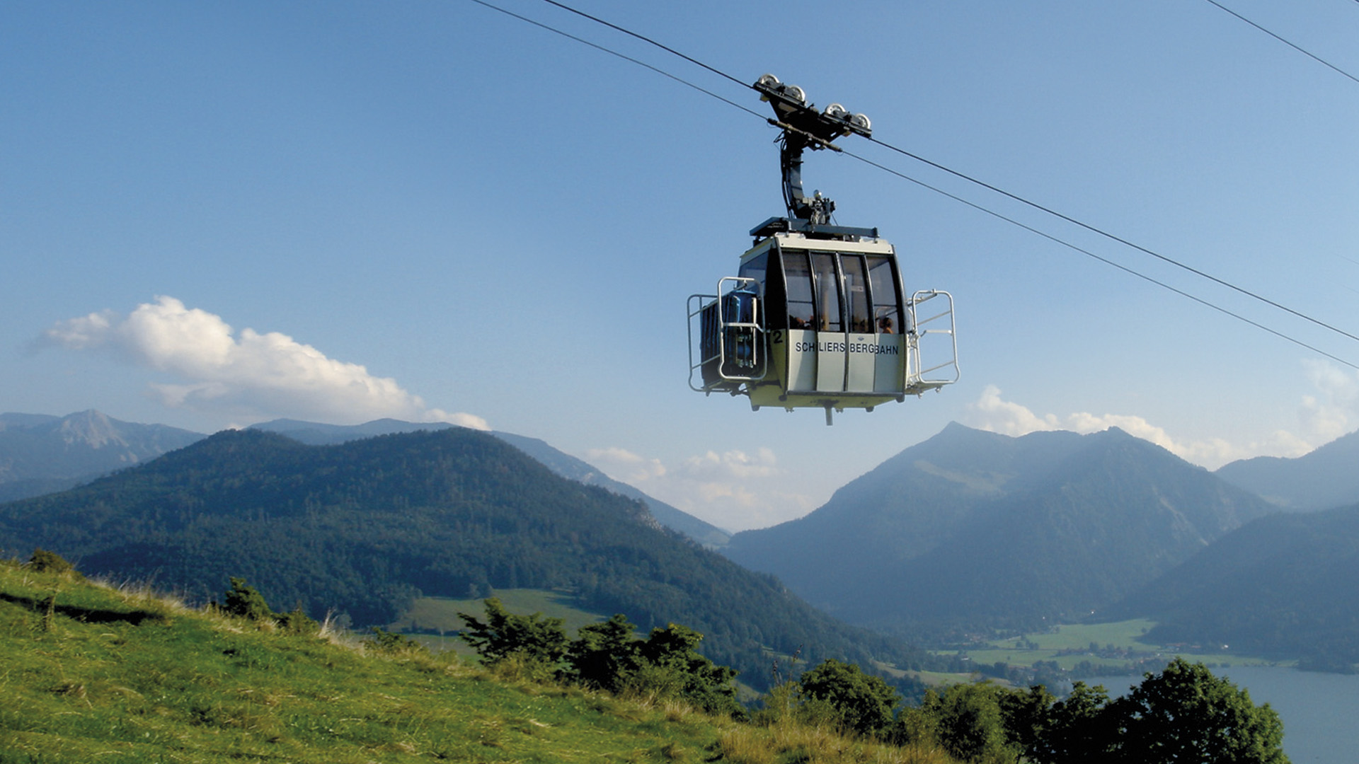
An easy and comfortable way to get to know the area around lake Spitzingsee and Schliersee is to hop onto the mountain railways. During summer the mountain railways will bring you up to the mountains. At a height of 1.100 metres to 1.800 metres you then can walk around, climb up the mountains or just hang around, lay in the sun in the middle of an Alpine meadow or enjoy yourself in an Alpine hut. The mountain railways „Taubenstein-Kabinenbahn” and „Stümpfling-Sesselbahn” will bring you to the mountain Taubenstein or Stümpfling in a few minutes time. From Rottach-Egern you can hop onto the „Sutten-Sesselbahn” and get off at the mountain called Stümpfling.
During summer the Taubensteinbahn is available every day from 9.00 a.m. to 4.30 p.m. The Stümpfling-Sesselbahn and the Sutten-Sesselban are in service from 9.00 a.m. to 5.00 p.m.
In winter the Taubensteinbahn is closed and the Suttenbahn and Stümpflingbahn operate from 8.30 a.m. to 4.20 p.m. Both mountain railways Stümpflingbahn and Suttenbahn are closed from the beginning of October until the start of the winter activities and during bad weather conditions, e.g. storms, heavy snow- or rainfall or thunder storms.
All little guests can enjoy playing at the playgrounds near the Taubensteingipfelstüberl, mountain stations, at the Alpine hut Jagahütt´n near the mountain called Stümpfling and at the bank of lake Spitzingsee. You will find location plans at the cash point of the mountain railways. A hiking brochure and other information is available in the internet at www.alpenbahnen-spitzingsee.de.
Overview of the mountain railways near lake Spitzingsee and Schliersee:
Alpenbahnen Spitzingsee
Lyraweg 6
83727 Schliersee/Spitzingsee
Tel.: +49 (0)8026 7304
E-Mail: info(at)alpenbahnen-spitzingsee.de
Internet: www.alpenbahnen-spitzingsee.de
Taubensteinkabinenbahn
Spitzingstrasse 12 (shortly before the tunnel)
83727 Spitzingsee
Tel.: +49 (0)8026 92922913
Internet: www.alpenbahnen-spitzingsee.de
not in winter season!
Stümpflingbahn
Lyraweg 6
83727 Schliersee/ Spitzingsee
Tel.: +49 (0)8026 9292230
E-Mail: info(at)alpenbahnen-spitzingsee.de
Internet: www.alpenbahnen-spitzingsee.de
Sutten-Sesselbahn
Sutten 33
83700 Rottach-Egern
Tel.: +49 (0)8022 24105
Internet: www.alpenbahnen-spitzingsee.de
At the Schliersbergalm you also can stay one or several nights. You can enjoy a one day trip, ride with the cabin lift and have something to eat at the hotel restaurant. Nearby you will find a holiday park with a giant trampoline. You also can ride on the steep tram railway or the summer toboggan-run. The track is 950 metres long and ends in the valley.
If you prefer to walk through the mountains - you will find a lovely hiking path to the Schliersbergalm. This tour will take you about 45 minutes and you will walk on a well equipped serpentine road. During the weekdays all Schliersee guestcard owners will get a discount for mountain railway rides.
contact: Schliersbergalm Tel.: +49(0)8026 6722 aerial railway: +49 (0)8026 6723
All year long it is worth to visit the Spitzingsee region. During summer, you and your family can have a great time climbing mountains, relaxing at lake Spitzingsee or Schliersee or going for a walk through the forests, the valleys and the mountains.
Hikers from all over the world visit the region of Schliersee during spring, summer and autumn. The hiking area is known as one of the most beautiful regions of the Bavarian foothills of the Alps. There are various kinds of tours for everyone. You can choose different levels of difficulty.
During your walk around the mountains „Stümpfling”, „Roßkopf” and „Taubenstein”, you also can enjoy the wonderful natural settings around you.
Please find a detailed description of every single track and duration of each tour in the brochure „Wandpanorama der Alpenbahnen Spitzingsee” at www.alpenbahnen-spitzingsee.de.
Enjoy travelling to the valley stations of the „Alpenbahnen Spitzingsee” via public transport or car. At lake Spitzingsee, the chair lift will take you to all starting points of your hiking tour. Children under 15 years, accompanied by their parents, are free of charge for a ride with the „Alpenbahnen Spitzingsee” during the summer holidays.
NEW!!! Near the mountain station of the „Stümpfling” and „Sutten” chair lift you will find a go-cart track called Mountaincart. The track is 3,5 kilometres long and leads to the valley. This new attraction opened in summer 2016. How about riding down the mountain after a long walk through the region of Schliersee. For more information, please visit the homepage www.alpenbahnen-spitzingsee.de.
(C) 2014 - 2018. All rights reserved. Markt Schliersee. Implementation TouriM GmbH.